

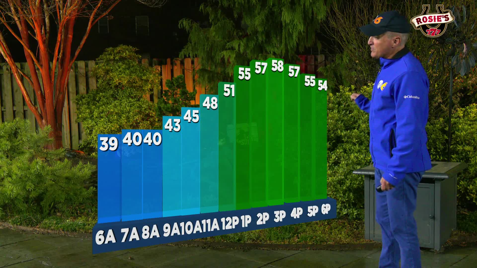

RICHMOND, Va. --Morning rain will give way to eventual clearing through the day, highs will climb into the upper 50s. Tonight will be mostly clear with a low in the lower 40s.
A milder stretch of weather begins tomorrow with temperatures approaching 60 degrees, continuing through at least Christmas Day.
Wednesday appears to be one of the warmer days with highs in the low 60s under mostly sunny skies.
Christmas Day will feature early morning rain giving way to partial sunshine and very warm temperatures for the holiday.
Friday will be much colder with cloudy skies and a high in the mid 40s.
A major pattern change arrives early next week when a frontal system moves through Sunday, bringing much colder temperatures to Richmond and central Virginia
Stay With CBS 6, The Weather Authority.
STORM TRACKING LINKS:
Weather Alerts
Closings & Delays
Interactive Radar
Map Center
📱 Download the new and improved CBS 6 Weather App for iPhone and Android.


