


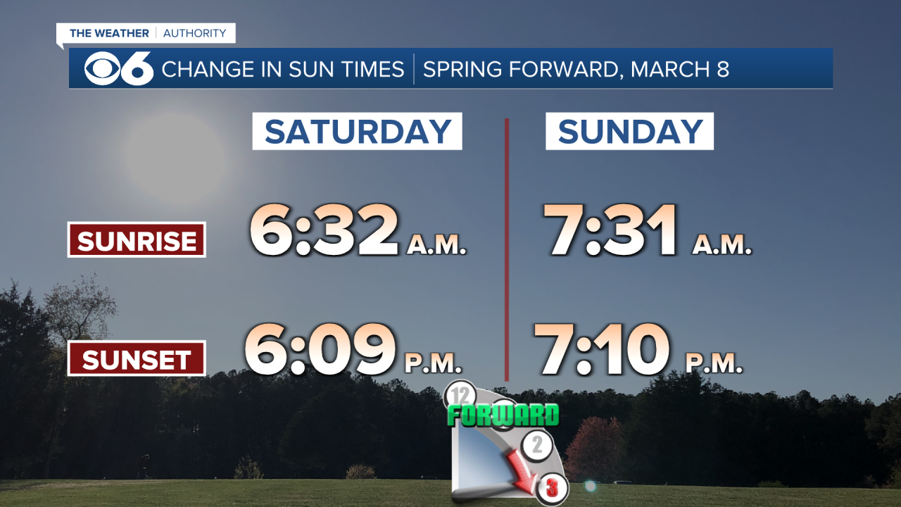
RICHMOND, Va. -- A pleasant night on tap with increasing clouds and lows in the 50s and 60s. This is the weekend clocks "spring forward" one hour at 2 a.m. Sunday to Daylight Saving Time.
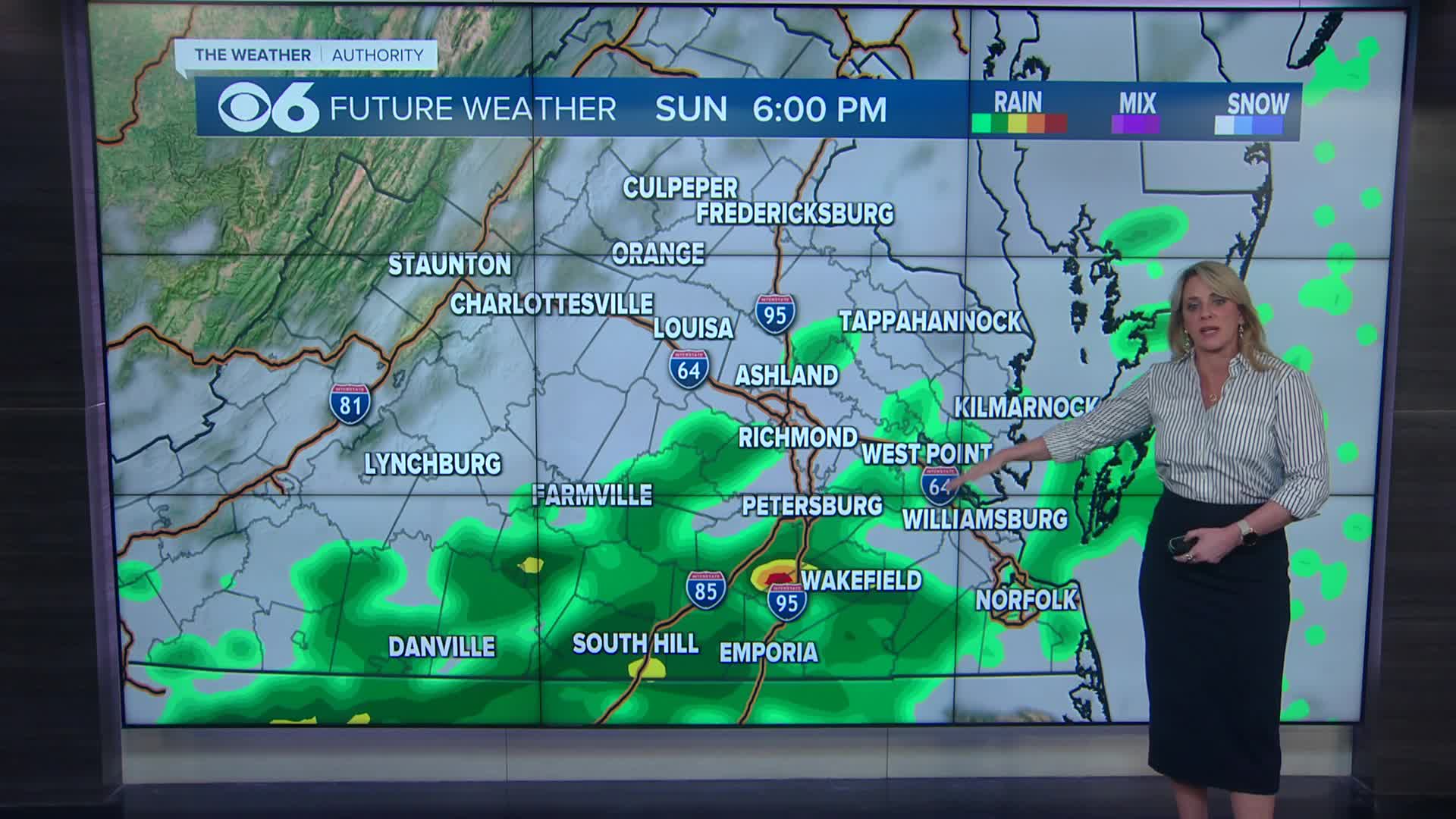
Sunday will be mostly cloudy with a bit of a breeze. An approaching cold front from the west will bring the chance of some scattered showers starting in the morning through the afternoon.
A few storms are possible late in the day into the evening across southern and southeastern Virginia. Highs will be in the 60s in northern and eastern Virginia, and in the 70s elsewhere.
Monday will be mostly sunny with highs in the mid to upper 70s.
Very warm air will arrive for Tuesday and Wednesday with highs in the low to mid 80s. The Richmond record highs are 81° (2006) for Tuesday, and 82° (1990) for Wednesday.
A shower is possible Tuesday, but a better chance for some showers will arrive Thursday.
It will be cooler later in the week, with highs in the 50s and 60s.
Stay With CBS 6, The Weather Authority.
STORM TRACKING LINKS:
Weather Alerts
Closings & Delays
Interactive Radar
Map Center
📱 Download the new and improved CBS 6 Weather App for iPhone and Android.


