

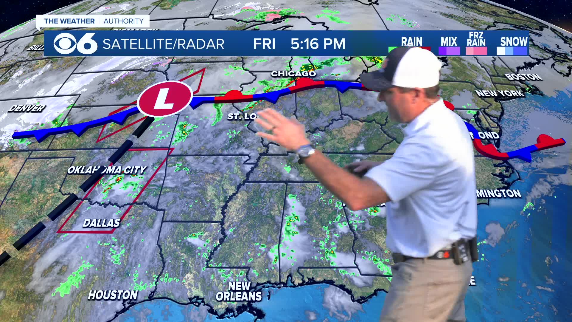

RICHMOND, Va. -- There will be a slight chance of shower this evening, with a better chance across northern Virginia.
Lows tonight will be in the 40s to lower 50s with areas of fog. A shower or some drizzle is possible.
Saturday will start with some clouds and fog, and perhaps a shower. Clouds will give way to sunshine. Southwesterly winds will increase with some gusts over 20 mph. Highs will be 75-80 for much of the area, but it will be cooler near the coast and in northern Virginia. A passing shower is possible in a few spots. A few storms may occur closer to I-81 in the evening.
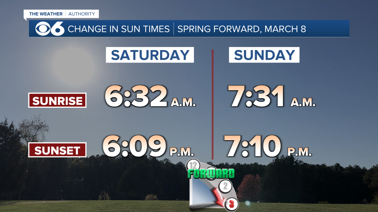
This is the weekend clocks "spring forward" one hour at 2 a.m. Sunday to Daylight Saving Time.
A cold front moving in from the west will bring the chance of a few showers the first half of Sunday. A few thunderstorms are possible later in the afternoon into early evening, mostly south and southeast of Richmond. Highs will be in the low to mid 70s.
Monday will be mostly sunny with highs in the mid to upper 70s.
Highs will get into the lower 80s on Tuesday. The Richmond record high is 81° from 2006.
Highs will reach the low to mid 80s on Wednesday. The Richmond record high is 82° from 1990.
A cold front will pass early Thursday. Highs will be in the 60s before noon, with temperatures dropping in the afternoon. Some showers will be around at times.
Friday will be much cooler with morning lows in the 30s, and afternoon highs in the low to mid 50s.
Stay With CBS 6, The Weather Authority.
STORM TRACKING LINKS:
Weather Alerts
Closings & Delays
Interactive Radar
Map Center
📱 Download the new and improved CBS 6 Weather App for iPhone and Android.


