

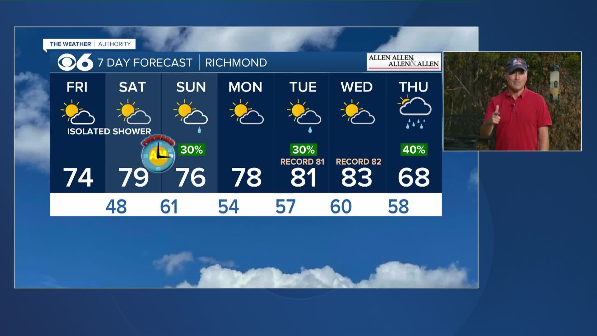

RICHMOND, Va. --A quasi-stationary front will push southwestward on Friday. Highs west of I-95 will be in the 70s to lower 80s. Highs east of I-95 will be in the upper 60s and lower 70s, but highs will be in the 50s along the coast. An isolated shower is possible in a couple of spots.
The front will shift northeastward a bit on Saturday, allowing many areas to hit 75-80 across central Virginia. It will be cooler near the coast. We will have a mix of clouds and sun, and a passing shower cannot be ruled out, mostly across northern and western Virginia, where thunder is also possible.
This is the weekend clocks "spring forward" one hour at 2 a.m. Sunday to Daylight Saving Time.
A cold front moving in from the west will bring the chance of a few showers on Sunday, but much of the day will be dry. Highs will be in the low to mid 70s.
Highs will return to the 80s on Tuesday and Wednesday, and record highs are possible.
A storm system will bring a better chance of showers on Thursday .
Stay With CBS 6, The Weather Authority.
STORM TRACKING LINKS:
Weather Alerts
Closings & Delays
Interactive Radar
Map Center
📱 Download the new and improved CBS 6 Weather App for iPhone and Android.


