

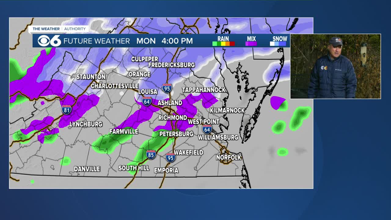

RICHMOND, Va. -- Our next system will bring the threat of some light snow or mixed precipitation Monday afternoon. Highs will range from the mid 30s northwest to the mid 40s southeast. A mix of snow, sleet and rain is likely into the night, with some freezing rain possible in areas north and northwest of Richmond. Temperatures will inch up a bit by daybreak Tuesday, switching any precipitation to some rain showers. Due to the rather brief period of any freezing rain, and temperatures rising, no major impacts are expected. There is a Winter Weather Advisory for far NW VA due to a light glaze of ice being possible later today and tonight. Highs Tuesday afternoon are likely to reach the mid and upper 40s, with some 50s possible to the south.
Warmer air will surge into the Mid-Atlantic for the rest of the week. Highs will get to around 70 Wednesday, and the mid and upper 70s Thursday through Saturday.
Our last 70° high was in late November. Our last 80° high was October 8.
Stay With CBS 6, The Weather Authority.
STORM TRACKING LINKS:
Weather Alerts
Closings & Delays
Interactive Radar
Map Center
📱 Download the new and improved CBS 6 Weather App for iPhone and Android.


