


RICHMOND, Va. — A flood watch will remain in effect until midnight as rain is exiting the area we anticipate a fairly dry night.

WATCH NOW: Live look at radar, current conditions across Virginia
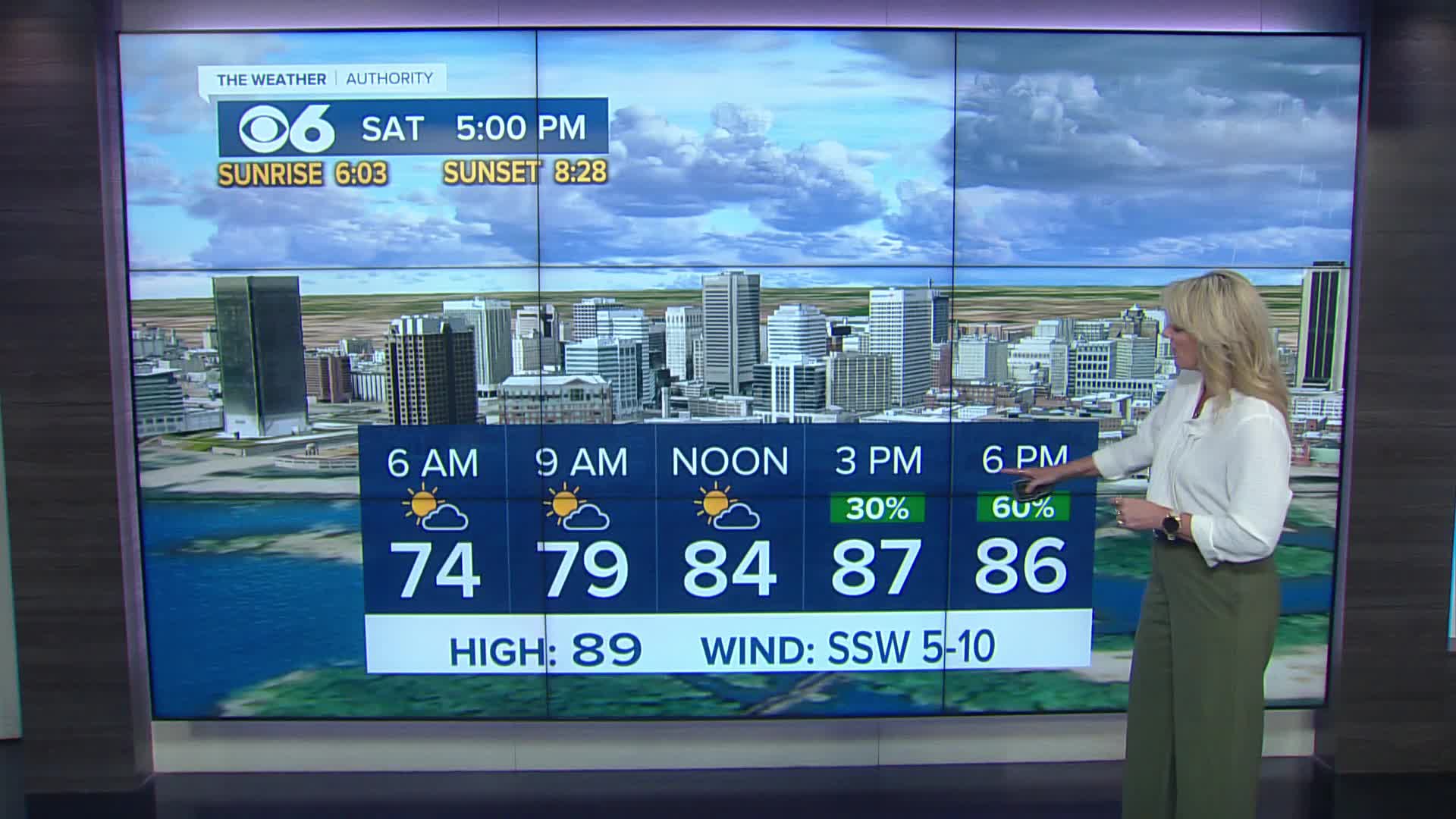
Saturday brings another round of scattered afternoon storms, particularly from 4 p.m. through 8 p.m., which could also produce heavy rainfall with high humidity continuing.
The good news arrives Sunday when rain chances decrease significantly. Most areas will stay dry Sunday and Monday.
Looking ahead to next week, our weather pattern will begin to change. Dew points will drop, bringing less humid conditions.
Overnight low temperatures, which have been stuck in the 70s, will fall to the upper 60s.
While still somewhat humid, this represents a notable improvement from the oppressive humidity we've experienced over the past couple of weeks.
Stay With CBS 6, The Weather Authority.
STORM TRACKING LINKS:
Weather Alerts
Interactive Radar
Map Center
Hurricane Tracker
Closings & Delays

Local News
'Significant flooding' strands drivers across Central Virginia
📱 Download the CBS 6 Weather App for iPhone and Android.


