

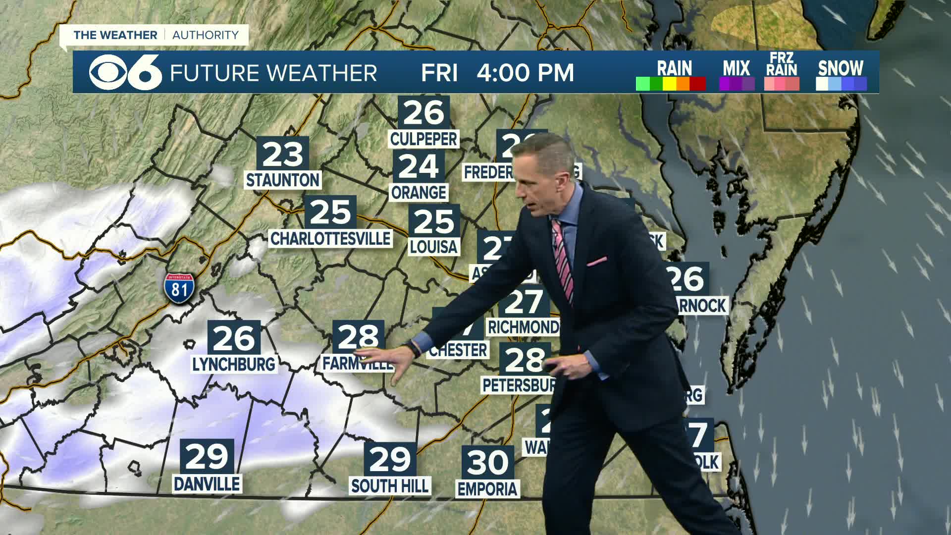

RICHMOND, Va. —Friday will have increasing clouds. A few flurries or some snow showers will be possible by late in the day, mostly well southwest of Richmond, where a light accumulation is possible. Highs will be 25-30.
A Winter Storm Watch is in effect for this weekend for central, southern and eastern Virginia.

Snow will move in from the south Friday night through Saturday morning, and will continue Saturday afternoon and Saturday evening.
Our latest computer models have been trending this storm farther south, which would put Richmond on the north edge of the storm. The advancing snow will also be fighting dry air from the north, which will limit the northward progression of the snow Saturday.
At this point, the best chance for snow accumulation will be near the North Carolina border over to Virginia Beach. Richmond city may get a light snow accumulation of a coating to 2". Areas south of Richmond will fall into the 2-4" range, with 4-7" possible closer to the North Carolina border.
This storm is still more than 24 hours away, so more adjustments to the forecast will occur. Should the storm track farther north, this would result in higher snow totals. However, model trends are moving more southeastward, which would bring snow accumulation potential downward.
An Extreme Cold Weather Watch is in effect Saturday night into Sunday morning. Breezy and cold conditions will produce wind chills between 0 and -10.
Sunday will have decreasing clouds and highs near 30.
Highs will be in the 30s to lower 40s next week. Overnight lows will still be cold, in the teens to lower 20s.
Stay tuned for updated forecasts for the weekend.
Stay With CBS 6, The Weather Authority.
📱 Download the CBS 6 Weather App for iPhone and Android.
Closings | Interactive Radar | Weather Alerts
iPhone News App | Android News App
iPhone Weather App | Android Weather App
Depend on the CBS 6 Weather Authority to keep you ahead of the storm. Watch CBS 6 News and stay with WTVR.com for complete coverage of this winter blast.


