


RICHMOND, Va. -- The clouds will thicken this evening, with showers developing across the region. There may some thunder, overnight as well mostly across southern Virginia. A few strong gusts are possible around daybreak. It will be warm with lows in the upper 50s and low 60s.
SEVERE WEATHER THREAT MONDAY — Damaging wind gusts, large hail and tornadoes possible

Monday will be windy and warm with highs in the 70s and wind gusts over 30 mph. There will be the threat for showers and a few thunderstorms during the morning, especially late morning and midday. A few of these storms may be severe. A line of more powerful storms will move in from the west as a cold front approaches during the afternoon.
There is a moderate risk (level 4 out of 5) of severe weather.

The main threat will be damaging wind gusts, possibly exceeding 70 mph. Some large hail over 1" in diameter is also possible.

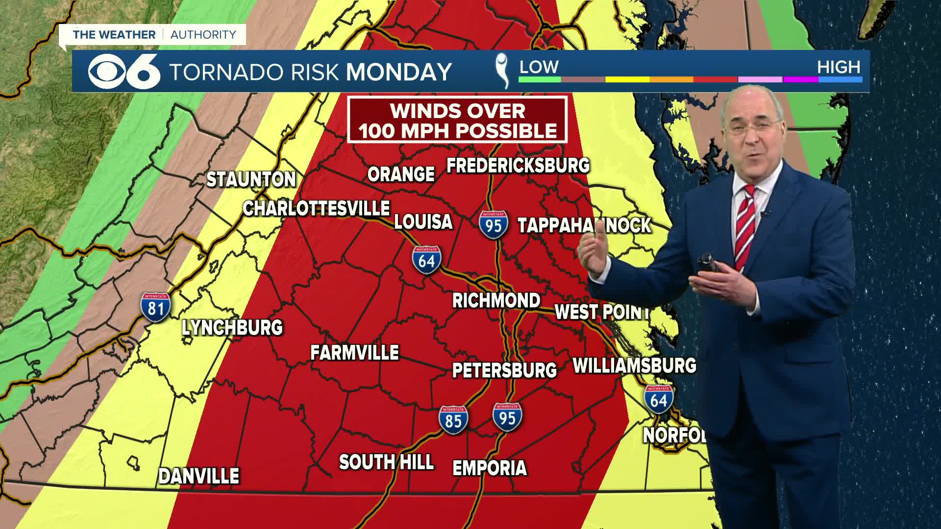
There is a risk of multiple tornadoes, some of which could produce winds over 100 mph. Due to the dynamics in place, these could be "long track" tornadoes, meaning they would stay on the ground for an extended period of time.

Storms should exit eastern Virginia by around 8 p.m. Final rain totals may exceed an inch in some areas.
Stay weather aware on Monday. 📱 Download the CBS 6 Weather Authority App for iPhone and Android.

Weather News
Important safety tips to have handy during severe weather
Gusty winds will usher in much colder air Monday into Tuesday. Highs on Tuesday will be in the mid 40s. Lows Tuesday night will be in the low and mid 20s, which will produce a hard freeze. Highs Wednesday will be in the mid to upper 40s.
Warmer air will move in later in the week, with highs around 60 Thursday, the mid 60s Friday, and near 70 Saturday.
Stay With CBS 6, The Weather Authority.
STORM TRACKING LINKS:
Weather Alerts
Closings & Delays
Interactive Radar
Map Center
📱 Download the new and improved CBS 6 Weather App for iPhone and Android.


