


RICHMOND, Va. -- An area of low pressure developing along a cold front will bring some rain to the area overnight. Lows will be in the mid 30s.
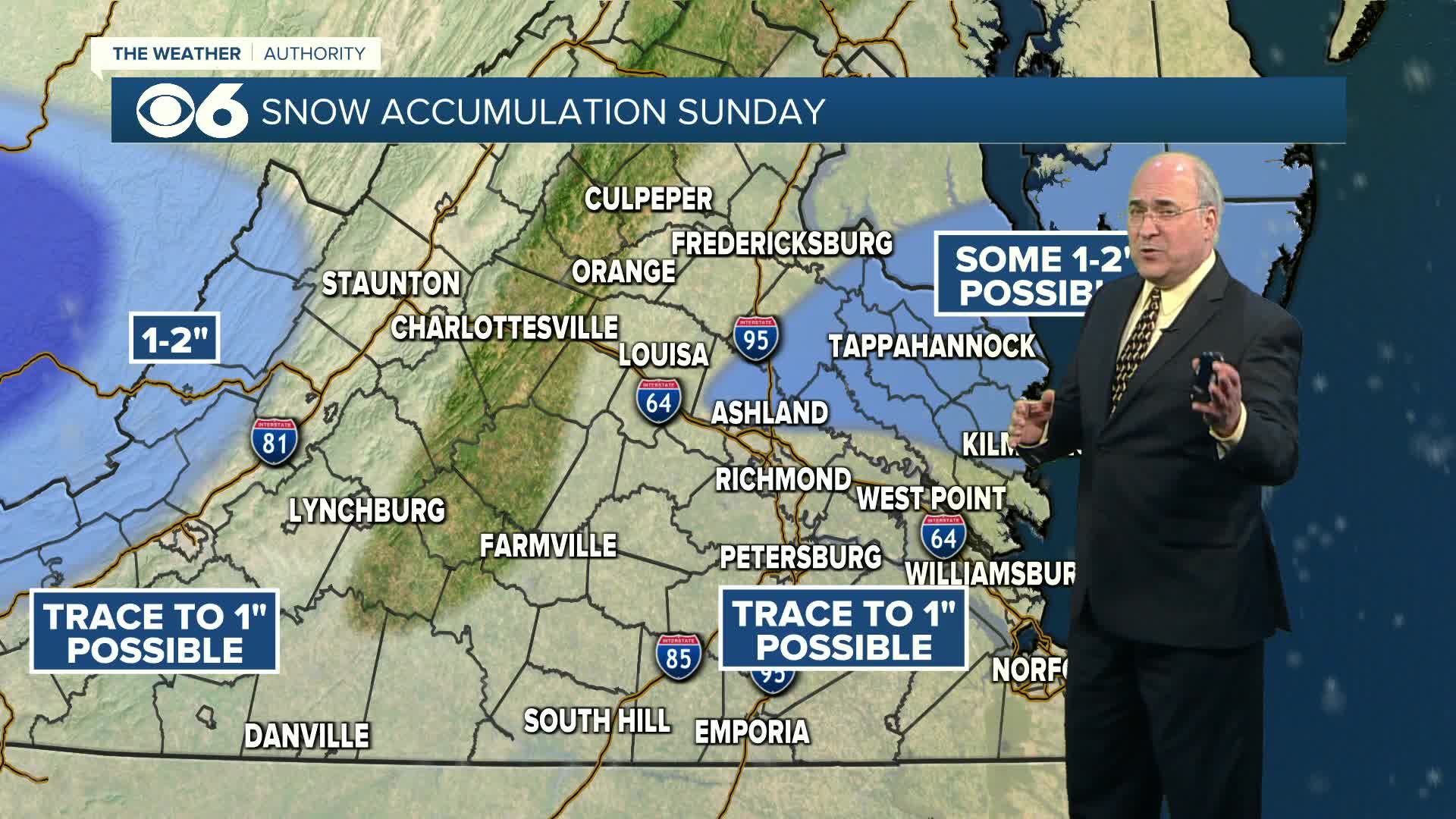
There may be a break in the precipitation Sunday morning, with more rain arriving by late morning/midday. As colder air moves into the region, the rain will mix with and change to wet snow from midday into the early afternoon (northwest to southeast). Areas well southeast of Richmond will likely stay mainly rain through mid-afternoon. Temperatures will remain slightly above freezing for much of the day, which will limit snowfall accumulation and keep the roads mostly wet. However, a slushy coating to one inch is possible in many places, on grassy and elevated surfaces. There is the potential for a little more (1-2 inches) in areas north of Richmond east to the Northern Neck and Middle Peninsula. A winter weather advisory is in effect Sunday for part of this area.

Sunday night will turn cold, with Monday morning lows in the teens and low 20s. Any standing moisture will turn icy. Monday will be sunny with highs in the low to mid 40s. Another cold front will move through, and lows Tuesday morning will be in the teens in most locations.
Tuesday will be mostly sunny and cold with highs in the low to mid 30s. Lows Tuesday night will be in the teens again. We'll rebound into the 40s the rest of the week. A passing shower is possible on Thursday, otherwise quiet weather will be the rule. The next system may bring some rain on Saturday.
Stay With CBS 6, The Weather Authority.
STORM TRACKING LINKS:
Weather Alerts
Closings & Delays
Interactive Radar
Map Center
📱 Download the new and improved CBS 6 Weather App for iPhone and Android.


