


RICHMOND, Va. -- A cold front will pass tonight, and bring the chance of a few showers or flurries. The best chance for precipitation will be north of I-64. Lows will be in the low to mid 30s.
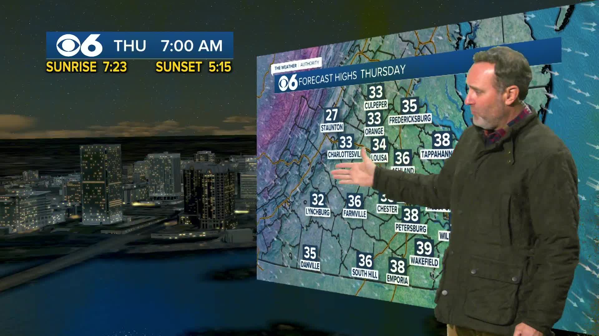
Thursday will be much colder with temperatures holding in the 30s all day. Some flurries are possible in the morning, with skies turning mostly sunny. Breezy conditions will keep wind chills in the 20s most of the day.
Thursday night will be very cold with lows in the teens to around 20.
Friday will have a mix of clouds and sunshine. Highs will be in the upper 30s and lower 40s. A few flurries are possible in northern Virginia.
Another cold front will pass on Saturday with the chance of a shower or a few flurries. Highs will range from the upper 40s to the mid 50s.
Sunday will be cold with highs in the 30s. Some of the computer models are showing a storm developing off the coast to our southeast. If this does develop, a period of light snow is possible. However, it is too early to pinpoint where exactly this storm will form. If it develops farther offshore, we may just get a few flurries or nothing at all.
The first half of next week will be cold with highs 35-40 and lows in the teens and 20s.
Stay With CBS 6, The Weather Authority.
STORM TRACKING LINKS:
Weather Alerts
Closings & Delays
Interactive Radar
Map Center
📱 Download the new and improved CBS 6 Weather App for iPhone and Android.


