


RICHMOND, Va. -- There will be some clouds around at times tonight. Some patchy fog is possible. Lows will be in the 30s.
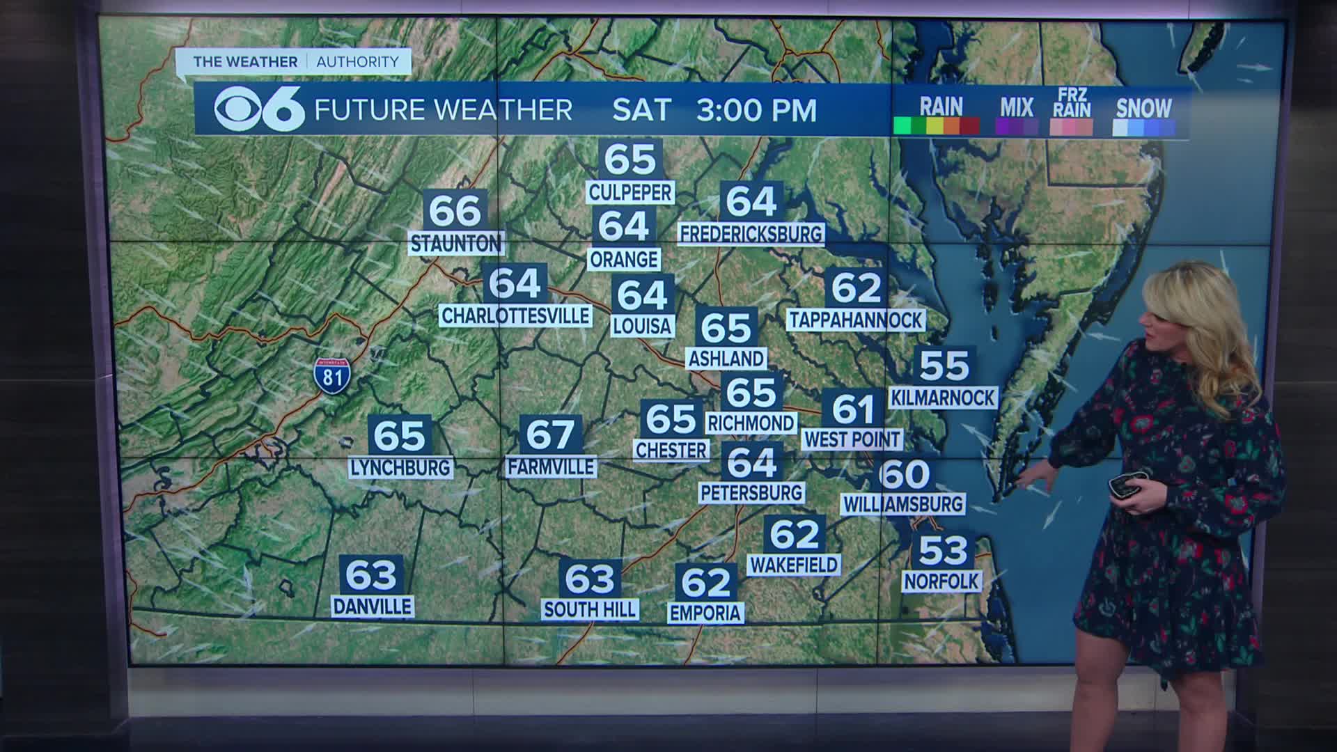
Saturday will be mostly sunny and warmer. Highs will reach the low and mid 60s across central Virginia, but will range from the lower 50s near the coast to some lower 70s far southwest of Richmond.
A cold front will pass on Sunday. Highs will be in the lower 50s near the coast, 55-60 well north of I-64, the low to mid 60s in metro, and the 70s across far southern Virginia. We will see a mix of clouds and sunshine. A spot or two could see a sprinkle as the front passes.
Monday will be colder with highs in the upper 30s to around 40. A disturbance will approach late in the day with the chance of some scattered light snow or sleet.
Precipitation will change from a mix to a period of freezing rain Monday night into early Tuesday, but the precipitation will then switch over to all rain. Highs Tuesday will be in the 40s.
Computer models still vary on this system for Monday into Tuesday. Some models now have our entire area dry, but one model has a higher chance of precipitation during this period. At this point, temperatures should be marginal enough that if we do get some wintry precipitation Monday evening into Tuesday morning, it will not be significant, perhaps some slick spots on untreated surfaces.
Temperatures will warm quickly next week, with highs around 60 Wednesday, around 70 Thursday, and at least the low to mid 70s Friday and next weekend. A few spots hitting 80 is not out of the question.
Our last 70° high was in late November. Our last 80° high was October 8.
Stay With CBS 6, The Weather Authority.
STORM TRACKING LINKS:
Weather Alerts
Closings & Delays
Interactive Radar
Map Center
📱 Download the new and improved CBS 6 Weather App for iPhone and Android.


