
RICHMOND, Va. -- Clouds will increase overnight. Lows will be mainly in the low to mid 40s for the metro, but will range from the upper 30s far northwest to around 50 south.
Saturday will start with some clouds and the slight chance of a shower, mostly south of Richmond. Clouds will decrease during the day. Highs will range from the mid 50s to the lower 60s. It will be cooler near the coast.
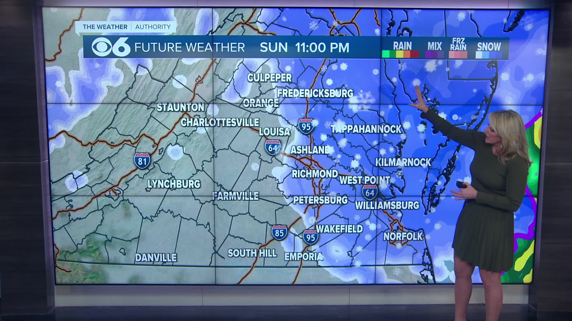
A coastal storm will impact the area on Sunday. Rain will develop in the morning and increase during the day. As some colder air dives south, the rain will mix and change to snow across northern Virginia. That transition line will track to the south and southeast late Sunday into Sunday evening. Highs will range from the mid 30s north to the mid 40s southeast.
A period of wet snow will be possible Sunday night, which will taper by Monday morning. Winds will gust over 30 mph.
Due to warmer air and ground temperatures, the initial batch of wet snow will have trouble sticking. As it turns colder, some light accumulations are possible in the metro, mostly on grassy surfaces. Snow showers will be stronger and last longer across northern Virginia over in the Northern Neck and Middle Peninsula, where over two inches of snow may accumulate.
Clouds will decrease Monday. Highs will be in the upper 30s and lower 40s, but with gusty winds, it will feel colder.
Lows will drop into the upper teens to mid 20s Monday night.
Highs will be in the lower 40s Tuesday, but will get back into the 50s for the rest of the week.
We will have a chance of rain Wednesday night and Thursday.
Stay With CBS 6, The Weather Authority.
STORM TRACKING LINKS:
Weather Alerts
Closings & Delays
Interactive Radar
Map Center
📱 Download the new and improved CBS 6 Weather App for iPhone and Android.