


RICHMOND, Va. -- Skies will stay cloudy this evening. A few sprinkles or passing showers will be possible, especially for areas well north and east of Richmond. Temperatures will slowly rise a few degrees overnight.
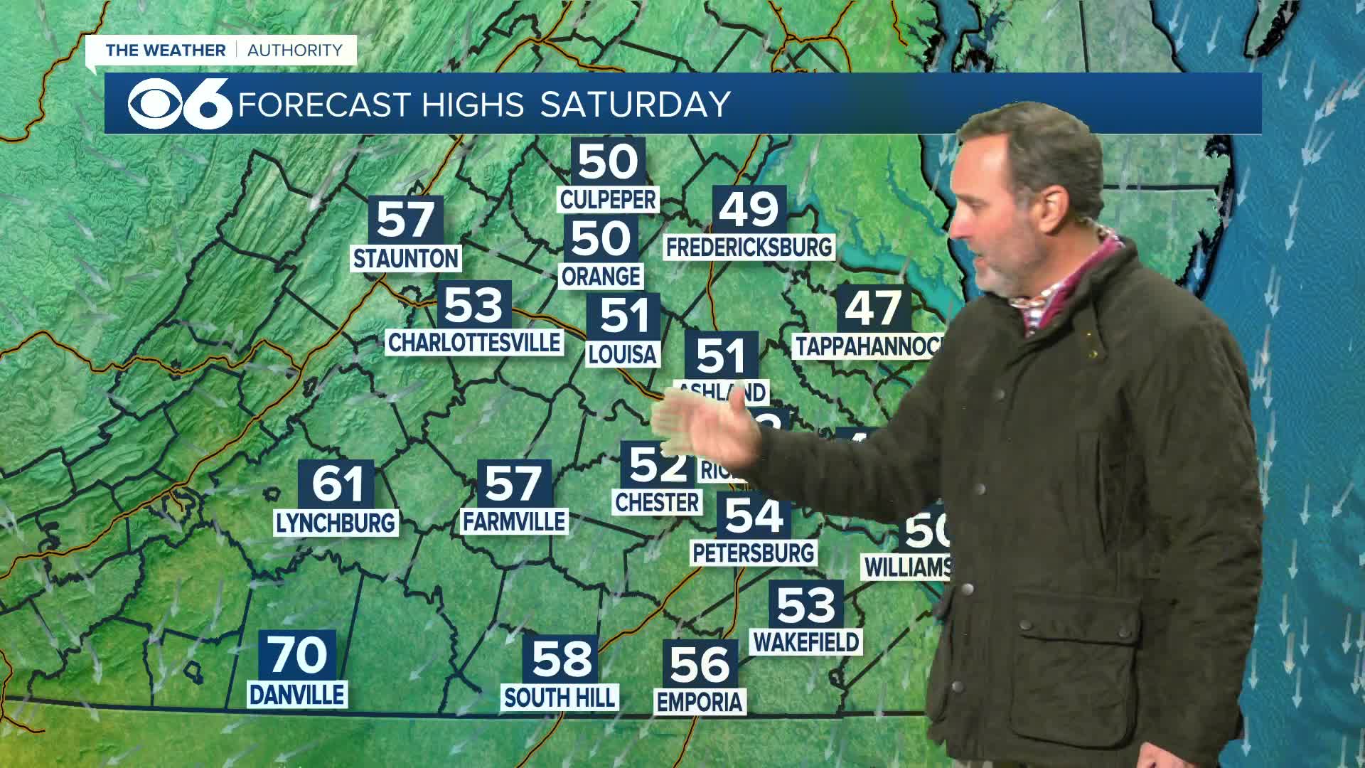
Saturday will have a mix of clouds and sun with highs ranging from the upper 40s to mid 50s across central Virginia, but it will be warmer to the southwest near Danville.
Sunday will be mostly cloudy with the chance of a few sprinkles. Highs will be in the upper 40s and lower 50s.
A strong cold front will pass on Monday with the chance of a few showers. Ahead of the front, highs will jump into the 60s. Some wind gusts over 30 mph will be possible.
Colder air will return for most of next week with highs in the 40s and lows in the 20s. Precipitation chances will be low.
New Year's Eve will be dry with midnight temperatures in the low to mid 30s.
Stay With CBS 6, The Weather Authority.
STORM TRACKING LINKS:
Weather Alerts
Closings & Delays
Interactive Radar
Map Center
📱 Download the new and improved CBS 6 Weather App for iPhone and Android.


