


RICHMOND, Va. -- It will be partly cloudy overnight with lows ranging from the mid 40s to around 50.
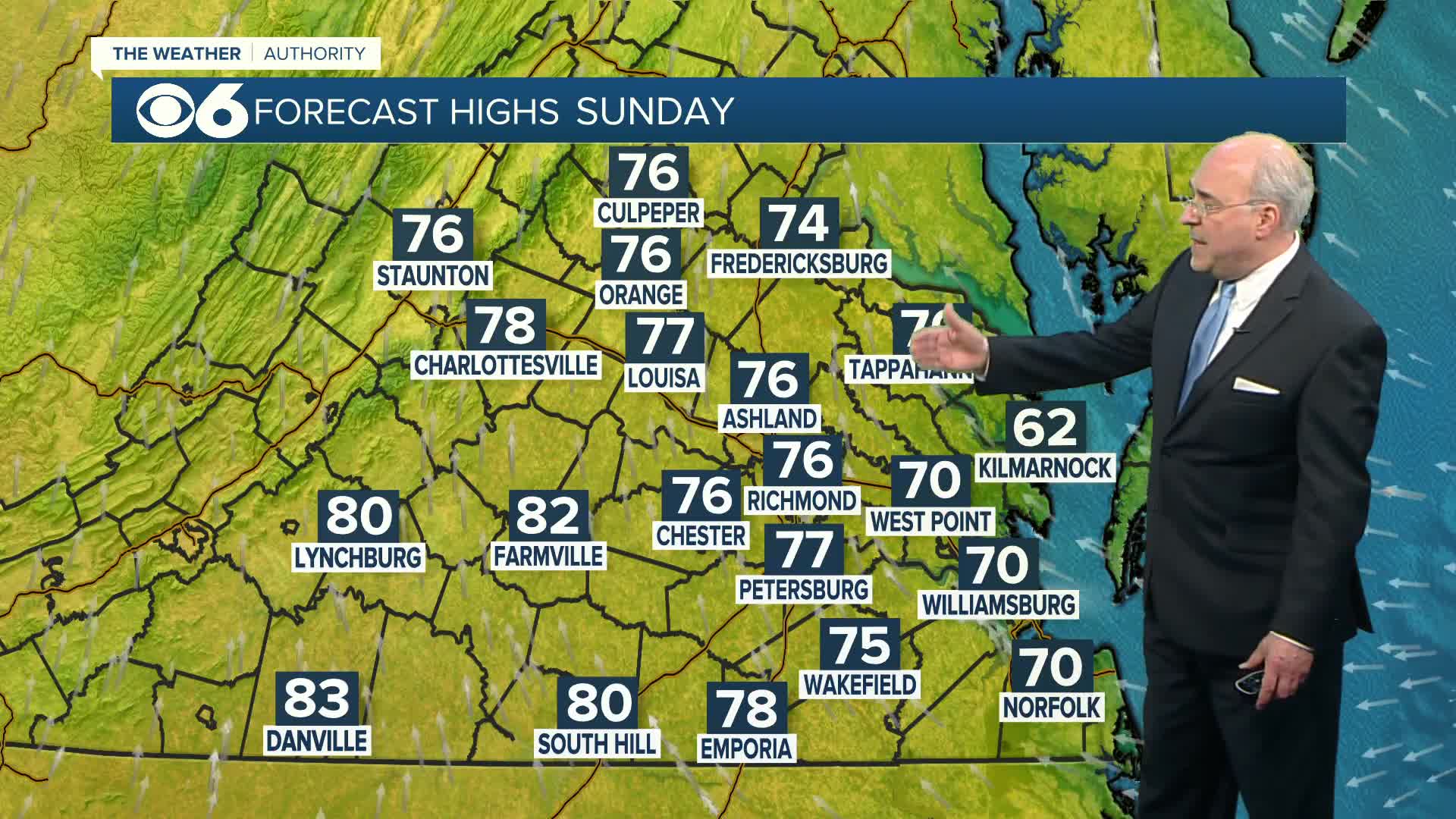
Sunday will have a mixture of clouds and sunshine. Afternoon highs will be in the mid to upper 70s. Then a significant warm-up is on the way for the week ahead. Away from the coast, highs will reach the low and mid 80s on Monday.
The heat will be on for the rest of the week, with a bit of a summer preview on tap. Many areas will be around 90 Tuesday, and in the low to mid 90s Wednesday and Thursday. Richmond record highs will be challenged: 90° Tuesday, 92° Wednesday, 93° Thursday. The overnight lows will be well into the 60s, and those could challenge some records as well.
A cold front will slowly approach the region Friday and Saturday, and might provide the opportunity for an isolated shower or storm.
Almost 90% of Virginia is now in drought status, with 49% in severe drought, and 40% in moderate drought. A tiny sliver of far southern Mecklenburg and Brunswick counties is now in extreme drought status.

Stay With CBS 6, The Weather Authority.
STORM TRACKING LINKS:
Weather Alerts
Closings & Delays
Interactive Radar
Map Center
📱 Download the new and improved CBS 6 Weather App for iPhone and Android.


