
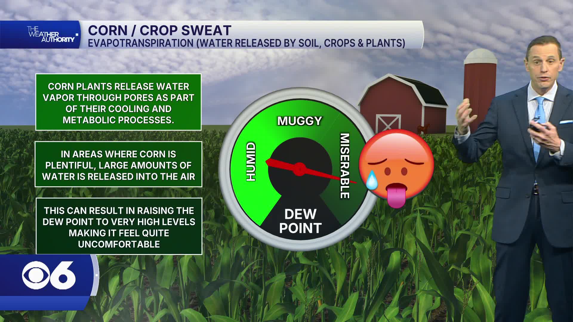


RICHMOND, Va. — A weather phenomenon known as "crop sweat" is pushing heat index values even higher in some parts of Virginia during one of the most dangerous heat waves the region has seen in years.
An Extreme Heat Warning continues for most of the region through Saturday. Highs Friday and Saturday will be near or above 100°, with heat index values exceeding 110° in spots. Overnight lows will be near record levels, in the mid to upper 70s, offering little relief from the dangerous heat.

Meteorologist Mike Stone says some areas with large concentrations of crops and plants are seeing even higher heat index values due to a process called evapotranspiration, commonly referred to as crop sweat.
Moisture travels up through the soil and crops and evaporates into the air, adding significant humidity to an already dangerous heat situation. Some spots in the viewing area are seeing feels-like temperatures exceeding 120°.
"What happens is the moisture that's down in the ground in the soil comes up through the plants and the crops, and it kind of gets evaporated through that," Stone said. "That's why some parts of our viewing area that have a lot of crops, or even just a big thicket of plants around, that's why it can be a lot more humid with a higher heat index in those parts of our viewing area."
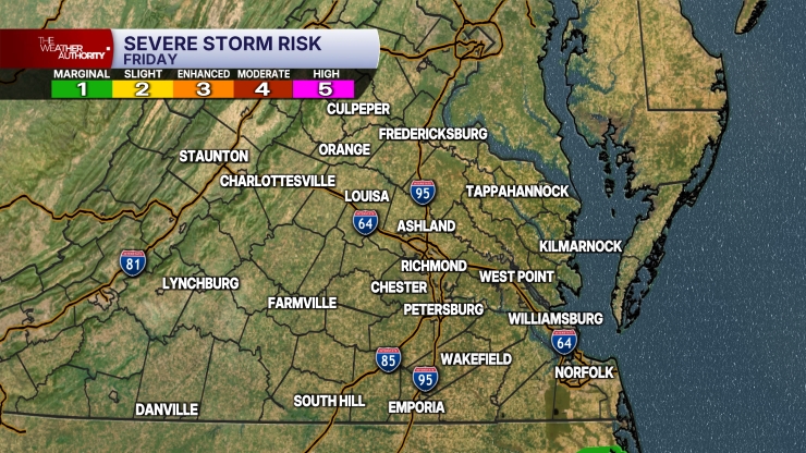
In addition to the dangerous heat, isolated storms are possible Friday afternoon and early evening, mostly west of Interstate 95. Any storm that develops could produce strong gusts and very heavy rainfall.
There will be a better chance of scattered storms Saturday afternoon and early evening. Much of the region is under a slight risk, level 2 out of 5, for severe storms due to strong gusts.
Highs Sunday will be in the mid to upper 90s, with a heat index exceeding 105°. Scattered storms are also possible Sunday afternoon and early evening, and some could be severe.
The heat will begin to ease slightly next week, with highs around 90°. Monday will bring a higher chance of showers and storms, with highs in the low to mid 90s.
-
Your Voice, Your Story
🎙️ WTVR Podcasts
-
Eat It, Virginia! with Scott and Robey
Untold with Catie Beck
This story was initially reported by a journalist and has been converted to this platform with the assistance of AI. Our editorial team verifies all reporting on all platforms for fairness and accuracy. To learn more about how we use AI in our newsroom, click here.
-
 Facebook
  TikTok
  YouTube
 Blue Sky
 Instagram
 Threads
 X
X


