




RICHMOND, Va. -- Coastal flood advisories continue in eastern Virginia through Friday. Prolonged onshore winds are pushing tidal levels 1 to 2 feet above normal at high tide, with minor to locally moderate flooding expected near the Chesapeake Bay, tidal James River and Atlantic Ocean.
Lows tonight will range from the upper 30s to mid 40s under clear skies.
A period of tranquil weather will settle in for the next week. Skies will be partly to mostly sunny. Highs will range from the mid 60s to the lower 70s. Overnight lows will be in the 30s and 40s, with frost possible many mornings in outlying areas.
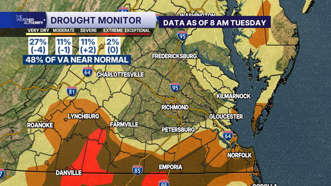
After seeing significant improvement since the summer, there were just a few minor changes over the past week in the updated drought monitor.
Far southern Virginia, near and south Highway 58, remains in a severe to extreme drought. Areas between Farmville and Danville remain in an extreme drought.
Almost half of the state is now near normal.
Stay With CBS 6, The Weather Authority.
STORM TRACKING LINKS:
Weather Alerts
Closings & Delays
Interactive Radar
Map Center
CBS 6 Hurricane Tracker
📱 Download the new and improved CBS 6 Weather App for iPhone and Android.


