


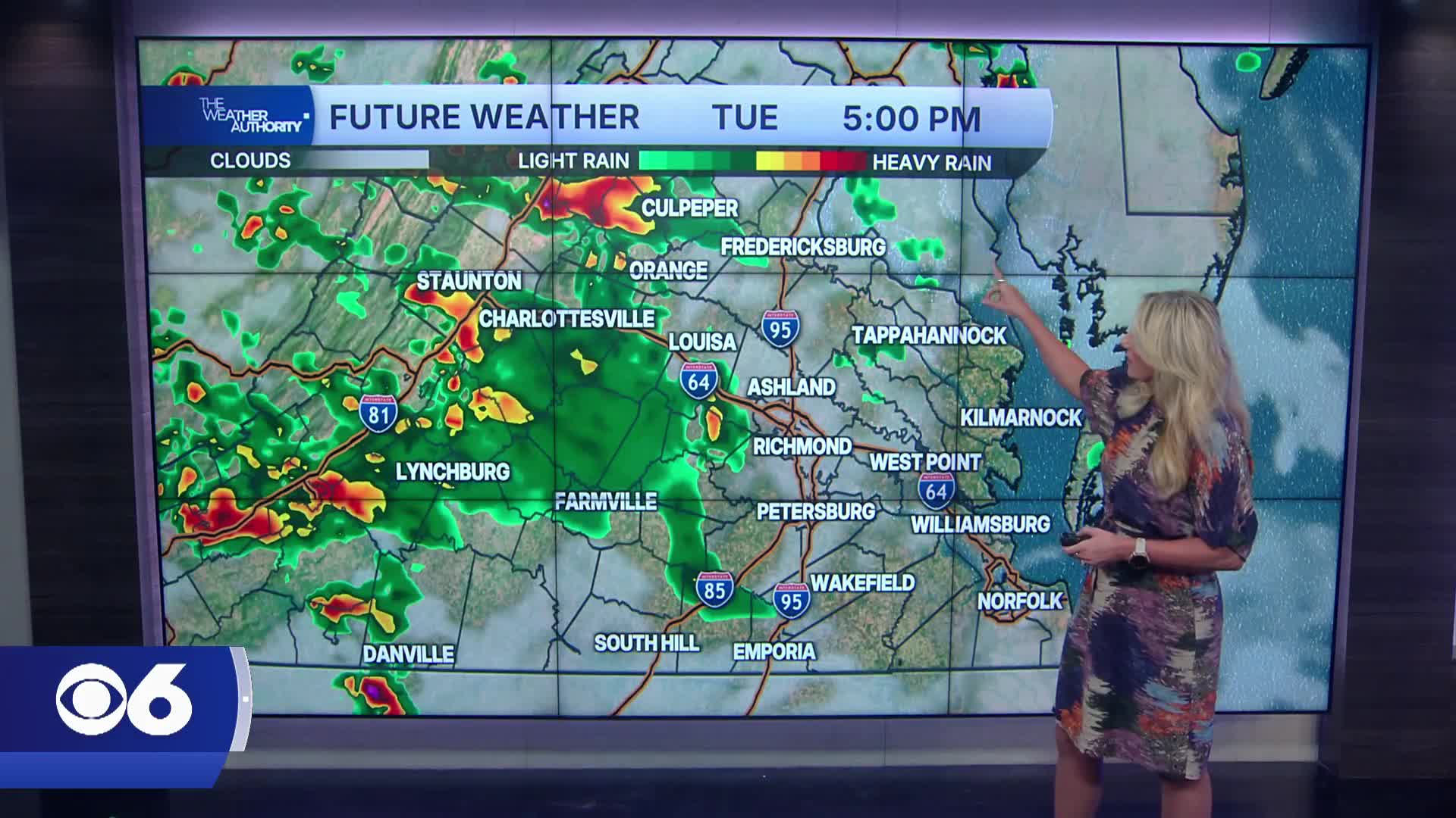


RICHMOND, Va. — Widespread showers and thunderstorms are expected across Central Virginia Tuesday afternoon and evening as a strong cold front moves through the region.
There is a slight risk (Level 2 of 5) for severe weather, with damaging wind gusts the primary threat. Large hail and a couple of brief tornadoes are also possible.
Storm timing will generally be between 3 and 8 p.m. for much of Central Virginia with storms moving quickly from northwest to southeast.
Temperatures Tuesday will climb into the upper 80s with humid conditions fueling stronger storms. Localized flash flooding cannot be ruled out in urban and poor-drainage areas.
Wednesday will feature a fair amount of sunshine with isolated showers or storms possible, mainly north of Richmond. Humidity will begin to decrease slightly behind the front.
Thursday and Friday look mainly dry with slightly below-average temperatures and lower humidity. Highs will generally remain in the low to mid 80s.
By the weekend, warmer and more humid summer air begins to return.
A few scattered thunderstorms may develop late Saturday into Sunday, with additional storm chances continuing into next Monday.
Stay With CBS 6, The Weather Authority.
STORM TRACKING LINKS:
Weather Alerts
Closings & Delays
Interactive Radar
Map Center
📱 Download the new and improved CBS 6 Weather App for iPhone and Android.


