


RICHMOND, Va. — Thunderstorms that developed Saturday afternoon brought localized downpours to central Virginia and RVA after a sunny and warm start to the weekend.
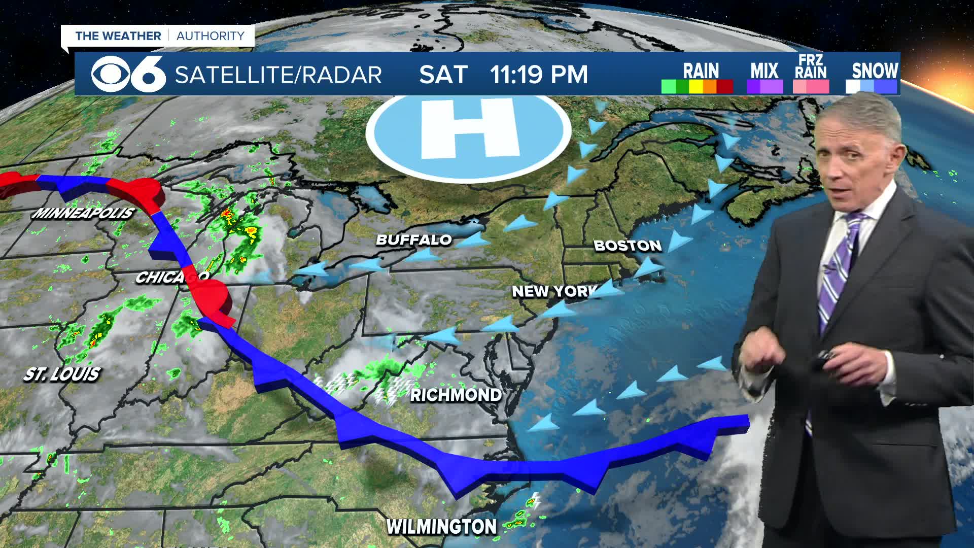
A backdoor cold front will drop to southern Virginia this evening, bringing an end to showers and storms.
That front is being pushed south by High pressure moving across southeastern Canada, and will help usher in cooler temperatures for Sunday.
Lows tonight will be mainly in the 60s, with the cooler and less humid air arriving later tonight into Sunday. Winds will shift, coming in from the northeast behind the front. (Those northeasterly winds will help build increasing waves along the coast, with high rip current risk at all coastal areas Sunday along with small craft advisories).
Weather during the day Sunday will start off with clouds and fog, and the chance for a shower or some sprinkles mainly during the morning. Clouds will decrease for the afternoon. It will be cooler with highs in the 70s.
Monday will be partly cloudy with highs in the upper 70s. The autumnal equinox, the astronomical start of fall, occurs at 2:19 p.m.
It will be a little warmer Tuesday and Wednesday with highs in the low to mid 80s. A few isolated showers or storms are possible mainly Wednesday.
Rain chances will then increase for the end of the week with daily high temperatures falling back a bit into the 70s.
Those increasing rain chances could get a boost by Friday into next weekend by Low pressure from offshore. We'll keep tabs on this for any potential tropical development, which at this time is not expected but worth watching.
Speaking of the tropics, climatologically we are now around the peak time of hurricane season, yet things remain pretty calm, at least with respect to U.S. weather. Gabrielle, located northeast of the Leeward Islands and southeast of Bermuda is expected to strengthen into a hurricane on Sunday, and pass just east of Bermuda into Monday, possibly as a category two hurricane. It will then curve to the northeast and head into the central Atlantic. Even with its far distance over the Atlantic, the storm could still enhance ocean wave heights along the East Coast. More details are available in the CBS 6 Hurricane Tracker.
Another tropical wave in the far eastern Atlantic shows low signs of development over the next several days.
Stay With CBS 6, The Weather Authority.
STORM TRACKING LINKS:
Weather Alerts
Interactive Radar
Map Center
Hurricane Tracker
Closings & Delays
📱 Download the new and improved CBS 6 Weather App for iPhone and Android.


