


RICHMOND, Va. -- Rain is ahead for most of Virginia the first half of this week, with Low pressure off the Carolina coast pushing inland from later Monday through Wednesday, bringing a prolonged period of wet weather.
Winds along the coast will be notably strong Monday and Tuesday, with Gale Warnings in effect from the lower Bay to the coastal Atlantic from Monday afternoon through Tuesday, as the pressure gradient between the Low and a large ridge of High pressure to the north strengthens. The winds will also increase across the northern Bay, with some coastal flooding possible particularly on the Eastern Shore.
Breaking down the forecast day by day for Central Virginia and RVA:
Monday could begin with a little bit of sunshine, but the clouds will come in quickly during the afternoon as the Low moves to the west and eventually inland. The clouds will give way to rain from southeast to north, with increasing rain chances towards evening. Highs will top in the upper 70s to near 80.
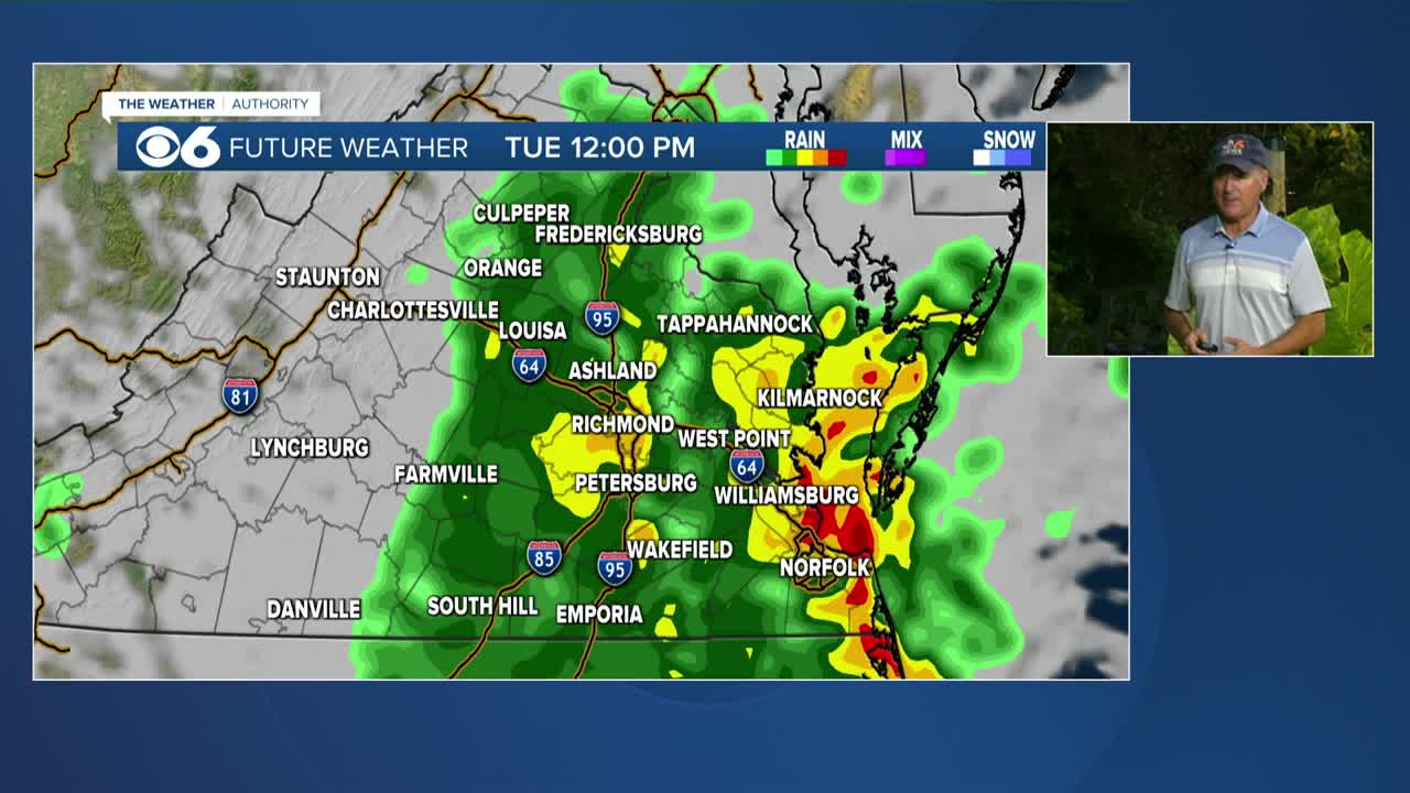
Tuesday will be the rainiest day, with heavy rain at times. High temps will not get out of the 60s, with some strong gusty winds from the northeast mainly along the coast.
Tuesday night and Wednesday bring more rainy skies, with continued cool temperatures. Rain totals from Monday night through Wednesday will be over an inch in many areas over southeastern Virginia, with 2 inches or more possible in some spots.
Skies will brighten Thursday, but a few showers could linger early. Friday should bring a sunny and warm end to the week.
Tropics: a tropical wave in the eastern Atlantic has a high chance of development this week as it tracks to the northwest, going north of the Lesser Antilles. If it becomes a named storm, it will be called Gabrielle.
Stay With CBS 6, The Weather Authority.
STORM TRACKING LINKS:
Weather Alerts
Interactive Radar
Map Center
Hurricane Tracker
Closings & Delays
📱 Download the new and improved CBS 6 Weather App for iPhone and Android.


