


RICHMOND, Va. -- Clear skies will be with us overnight, and it will be calm and cool. Lows will be in the 40s to low 50s. A patch or two of fog can't be ruled out.
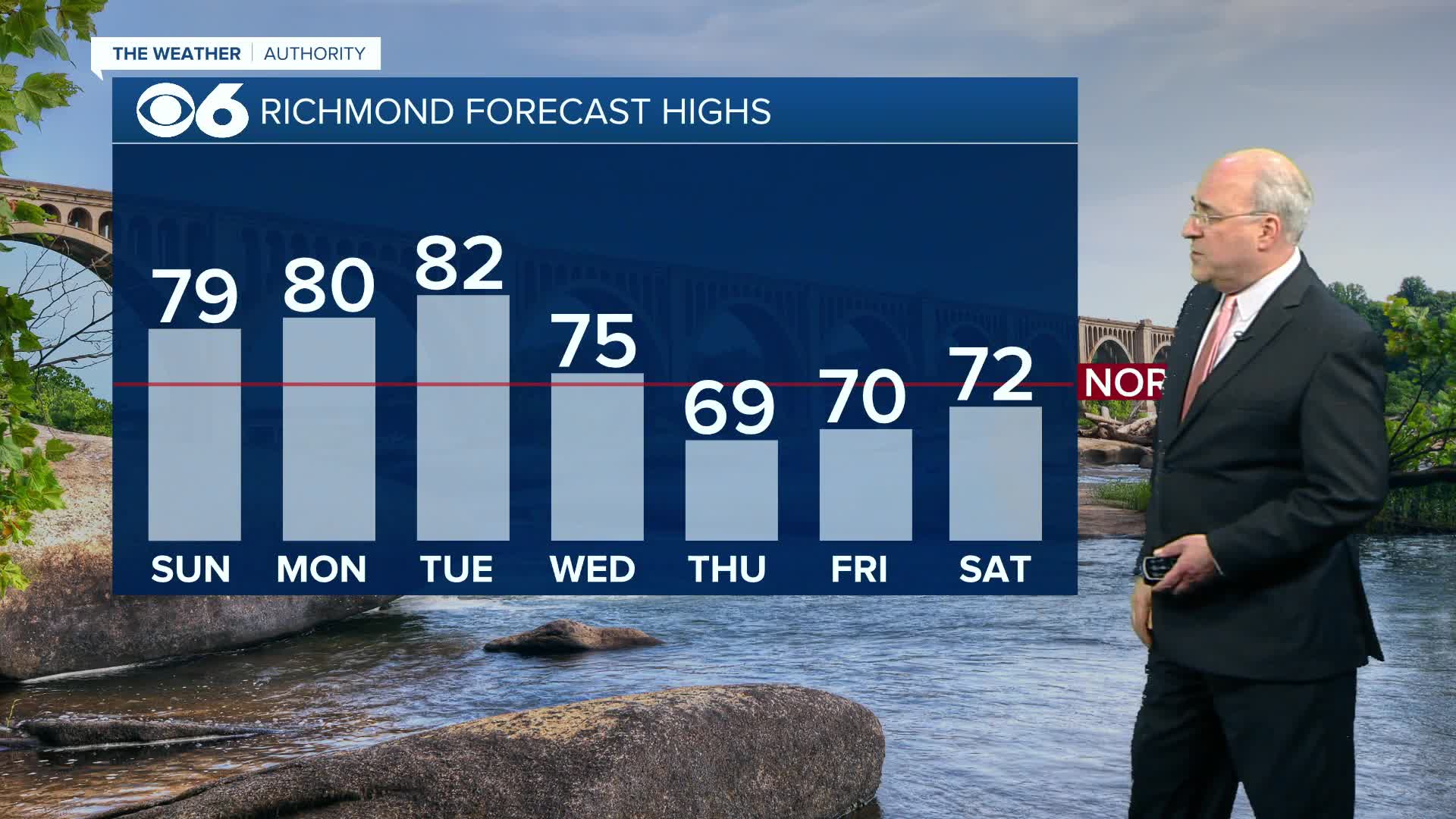
Sunday will be sunny and a bit warmer, with afternoon highs in the upper 70s and low 80s. That trend for warmer afternoons will continue Monday and Tuesday, with dry conditions and highs again in the upper 70s and low 80s.
A cold front will bring some showers on Wednesday, with a few rumbles of thunder possible. Highs will be in the low to mid 70s. Behind the front, we'll cool down a bit for the end of the week, with highs in the upper 60s and low 70s. Overnight lows will return to the 40s and low 50s.
In the tropics, an area of low pressure associated with a tropical wave has formed in the eastern Atlantic a few hundred miles south of the Cabo Verde Islands. Conditions are favorable for some development, and it could become a tropical depression by the middle of the coming week as it tracks through the central Atlantic. By the way, the next name on the Atlantic list is Jerry.
Stay With CBS 6, The Weather Authority.
STORM TRACKING LINKS:
Weather Alerts
Interactive Radar
Map Center
Hurricane Tracker
Closings & Delays
📱 Download the new and improved CBS 6 Weather App for iPhone and Android.


