


RICHMOND, Va. -- Tonight will not be as cold as last night, with lows mostly in the upper 30s and low 40s. A passing sprinkle or light shower is possible.
Plenty of clouds will be around on Sunday, although most of us will see a few occasional breaks of sun. Highs will be in the upper 50s and low 60s.
A storm system will pass to our south Monday into Tuesday. Some showers are possible, mostly well south of I-64. Highs will be in the upper 50s to around 60°. A second system will increase rain chances over the entire area later Wednesday into Thursday. The breeze will kick up later this week as well, with drier air arriving in time for Halloween and next weekend.
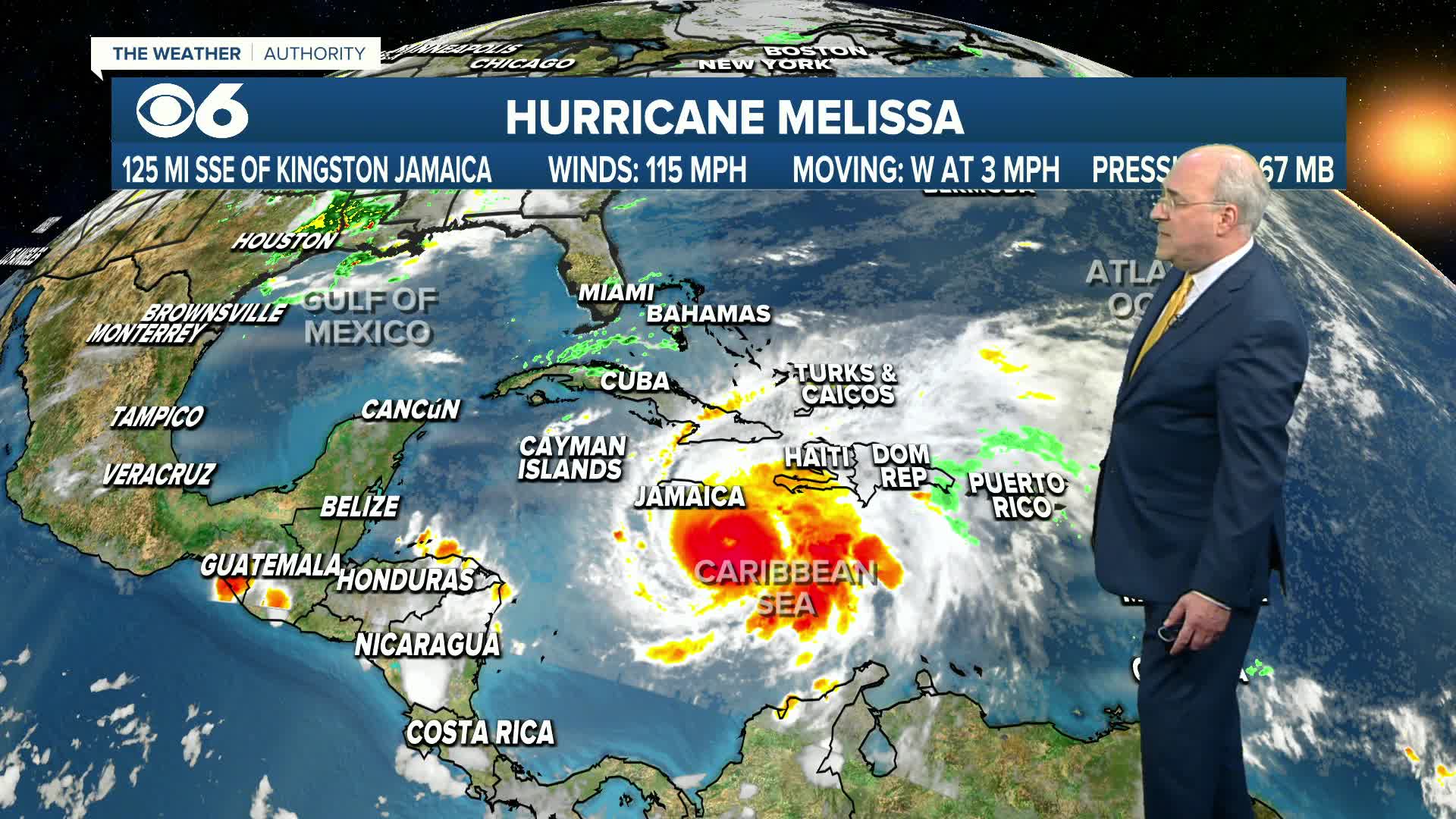
In the tropics, Melissa is now a major hurricane and will track slowly towards Jamaica over the next day or two, arriving there Monday night and Tuesday morning, possibly as a category 5 storm. It should then move north over eastern Cuba later Tuesday into Wednesday morning. Projections are for the possibility of two to three *feet* of rain, with up to 40 inches over Jamaica.
More information is in the CBS 6 Hurricane Tracker.
Stay With CBS 6, The Weather Authority.
STORM TRACKING LINKS:
Weather Alerts
Interactive Radar
Map Center
Hurricane Tracker
Closings & Delays
📱 Download the new and improved CBS 6 Weather App for iPhone and Android.


