

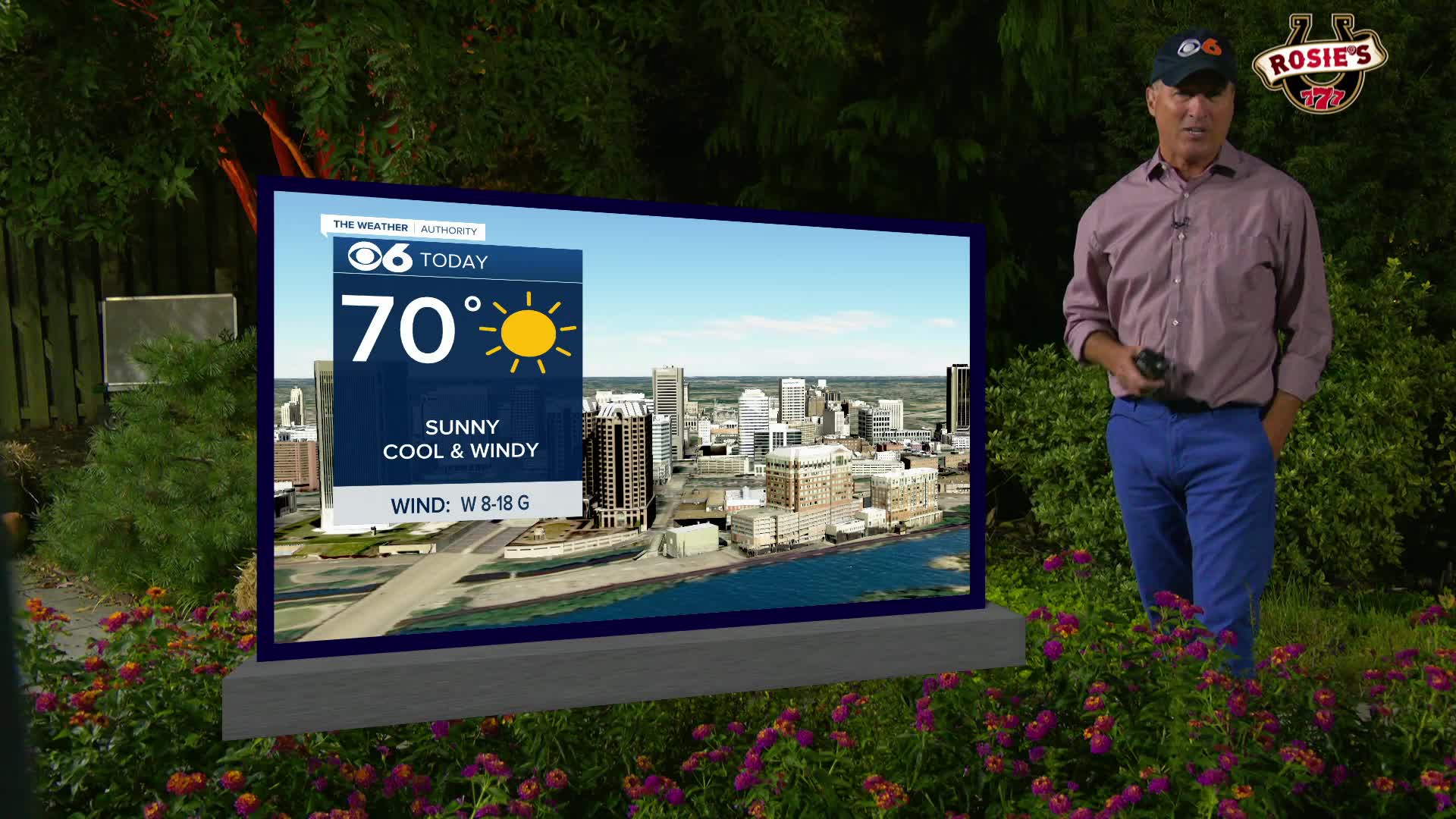

RICHMOND, Va. --Monday will be sunny, cooler and still breezy at times. Highs will be in the upper 60s to around 70. Lows Monday night will range from the mid 30s northwest to the mid 40s southeast.
Tuesday will be sunny and warmer with highs in the low to mid 70s. Another cold front will pass through the region Tuesday night, but any chance of rain will likely be low and confined to northern Virginia.
The rest of the week will be cool and dry with highs in the 60s and lows in the 30s and 40s.
As of now, next weekend looks dry Saturday, with more clouds and possibly a couple of showers on Sunday.
In the tropics, a tropical wave approaching the Windward Islands has a good chance of development as it heads into the Caribbean Sea during the next few days. If it becomes a named storm, it will be called Melissa.
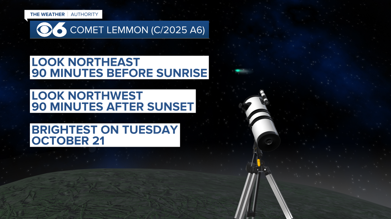
If you see something wispy-looking in the skies the next few days, it is the Comet Lemmon. It has been visible to the naked eye, but further detail can be seen with binoculars or a telescope.
Stay With CBS 6, The Weather Authority.
STORM TRACKING LINKS:
Weather Alerts
Interactive Radar
Map Center
Hurricane Tracker
Closings & Delays
📱 Download the new and improved CBS 6 Weather App for iPhone and Android.


