


RICHMOND, Va. -- Tonight will be clear and cold. Lows will be in the upper 30s and lower 40s away from the coast, but some readings of 33-36 are possible in our coldest outlying areas. Some patchy frost is possible for areas west of I-95.
Friday will be sunny with highs in the low to mid 60s.
Saturday will start in the 40s and warm into the low to mid‑70s with a mix of sun and clouds, but dry.
Sunday will be the warmest day, upper 70s, under dry skies as high pressure holds.
Late Sunday night, a cold front will bring light showers and maybe an isolated thunderstorm that quickly moves out by early Monday.
Next week turns cooler and pleasant, with highs in the 60s. Another front may pass Tuesday night, but it looks too dry to bring rain.
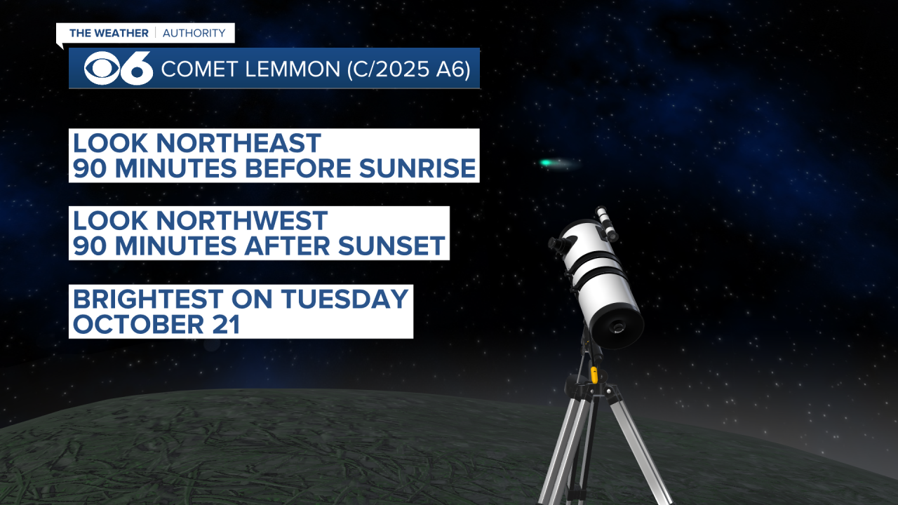
If you see something wispy-looking in the skies the next few days, it is the Comet Lemmon. It appears in the northwestern sky around 90 minutes after sunset, and in the northeastern sky 90 minutes before sunrise. It will appear the brightest on October 21. It has been visible to the naked eye, but further detail can be seen with binoculars or a telescope.
Stay With CBS 6, The Weather Authority.
STORM TRACKING LINKS:
Weather Alerts
Interactive Radar
Map Center
Hurricane Tracker
Closings & Delays
📱 Download the new and improved CBS 6 Weather App for iPhone and Android.


