



RICHMOND, Va. -- A dry cold front is sweeping through the area this morning setting the stage for a breezy Monday with sunshine, highs in the 60s and wind gusts up to 25-30 mph.
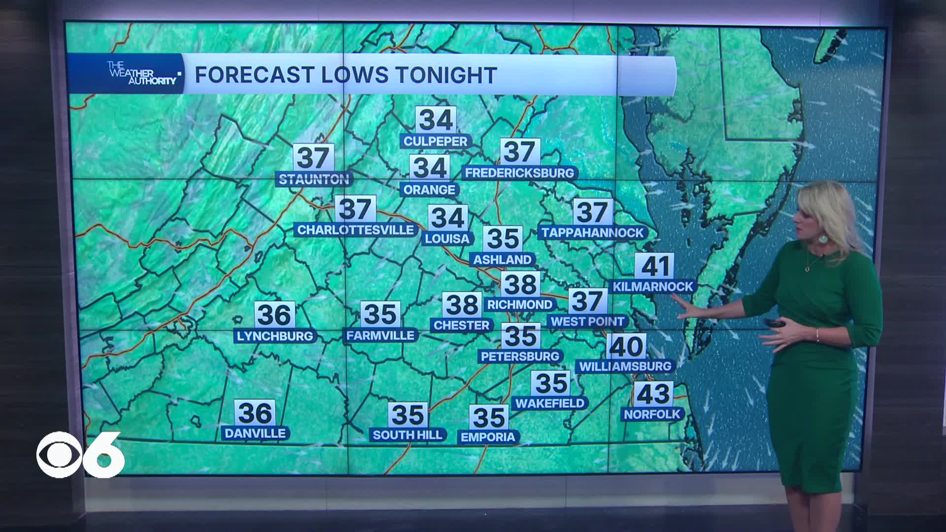
Tonight, temperatures drop into the 30s for most inland areas and a light freeze with patchy frost is possible across rural interior Virginia — a Frost Advisory may be issued for areas still in the growing season.
Tuesday stays dry and comfortable with highs climbing to the upper 60s to around 70.
Tuesday night lows settle back into the 30s inland and 40s near the coast.
Wednesday warms a bit more with lower 70s possible across interior Virginia, though clouds begin to thicken late in the day as the next system approaches.
Wednesday night stays mild with lows in the 40s area-wide.
Thursday remains mostly dry through the day with highs in the 60s, but rain develops Thursday night ahead of a strong cold front.
Rain lingers into Friday morning with the best chance for meaningful rainfall north and northeast of I-64, amounts look light overall, though some spots could see close to a half inch.
The weekend turns noticeably colder with highs only in the 50s, overnight lows near freezing and briefly into the upper 20s in spots, but conditions stay dry.
Stay With CBS 6, The Weather Authority.
STORM TRACKING LINKS:
Weather Alerts
Closings & Delays
Interactive Radar
Map Center
CBS 6 Hurricane Tracker
📱 Download the new and improved CBS 6 Weather App for iPhone and Android.


