
RICHMOND, Va. -- Showers and storms are tracking through central and eastern Virginia this morning. Expect locally heavy rainfall along with frequent lightning. Some wind gusts over 40 mph are possible.
WATCH: Live radar and current conditions
There will be a lull in the rain by mid to late morning, before another wave of showers and storms moves in from the south by midday, lasting into the afternoon. Rainfall will be heavier east and southeast of Richmond.
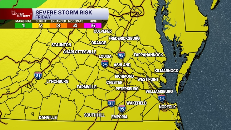
Some isolated higher gusts are possible with the storms, and eastern and southeastern Virginia are under a marginal risk (level 1 out 5) for severe weather. An isolated tornado cannot be ruled in far southeastern Virginia, outside of the CBS6 viewing area.
Highs will range from the mid 60s to the lower 70s.
Drier air will work in this evening. Lows overnight will be in the upper 40s and lower 50s.
The weekend will be mostly sunny with highs in the low to mid 60s. Lows Saturday night will be in the mid 30s to lower 40s.
Dry weather is expected through mid-week. Highs will be in the 60s to lower 70s, with lows in the 30s to lower 40s.
Some showers may return to the region on Thursday, followed by cooler weather leading into next weekend.
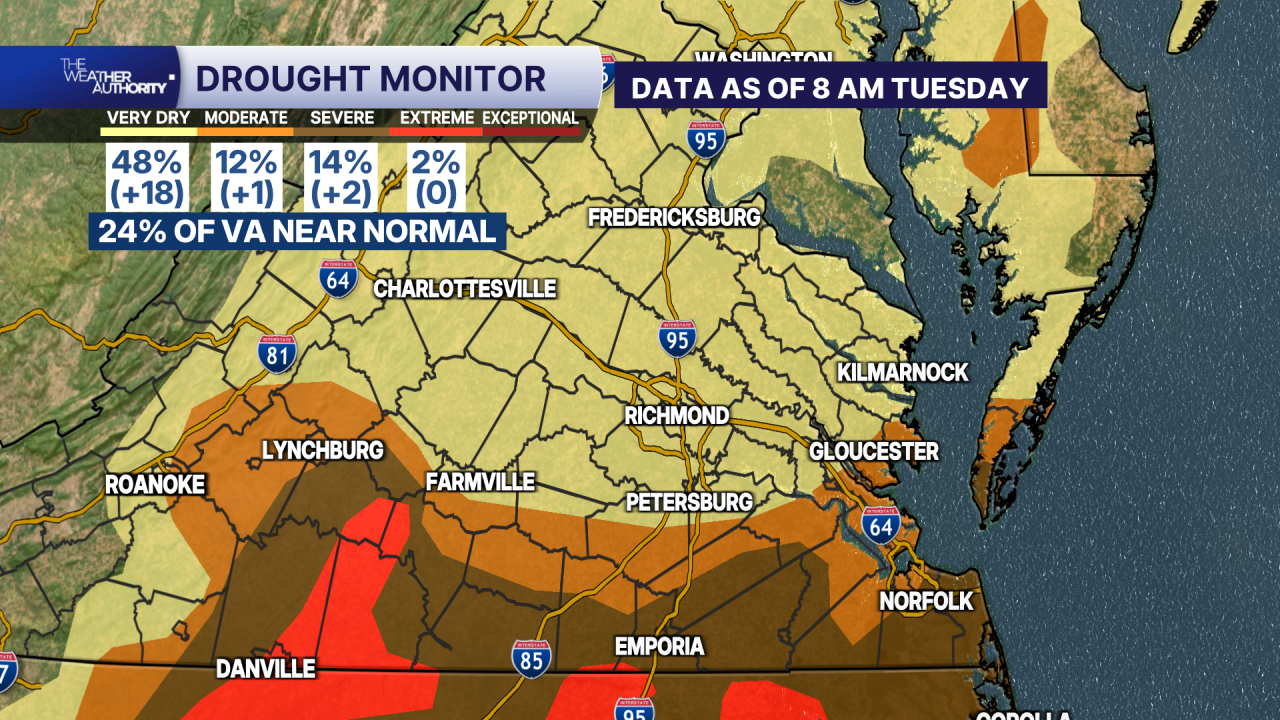
The amount of the state with near-normal rainfall decreased by 21%.
Severe to extreme drought continues to impact southern Virginia and areas between Farmville and Danville.
Much of the Richmond metro area is now in the abnormally dry category.
Stay With CBS 6, The Weather Authority.
STORM TRACKING LINKS:
Weather Alerts
Closings & Delays
Interactive Radar
Map Center
CBS 6 Hurricane Tracker
📱 Download the new and improved CBS 6 Weather App for iPhone and Android.