


RICHMOND, Va. -- After some rain to welcome the weekend, look for drier conditions to prevail over the region Sunday through Monday. A secondary dry cold front Sunday night will usher in cooler temperatures into Monday, followed by a warmup on Tuesday and Wednesday.
Lows tonight across Central Virginia and RVA will fall to the lower 40s. There will be some clouds and fog as well through around sunrise Sunday.
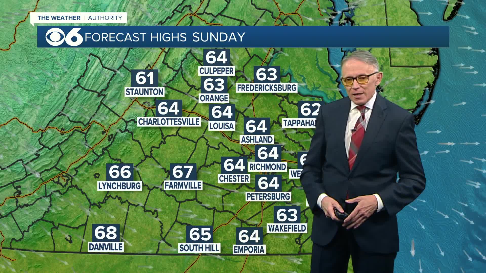
After some early clouds on Sunday, it will turn mostly sunny with highs in the low to mid 60s. Slightly cooler air arrives Sunday night and Monday, with temperatures in the 30s Monday morning, then topping out in the upper 50s afternoon. Skies will be mostly sunny, with some clouds on the increase later in the day.
Our next front will bring a chance of showers by later Tuesday. We will have rain likely Tuesday night into Wednesday morning, with breaks in the clouds during the day Wednesday. Highs will be unseasonably warm - near 70, with colder temps following the front to take us into Thanksgiving Day.
Travel weather Wednesday will be showery over the mid-Atlantic region early in the day, then again during the afternoon, mainly to the south and east of RVA. There could even be a few thunderstorms with the front over the Carolinas.
Thanksgiving will be breezy and much cooler with a mix of sun and clouds over Virginia, with highs in the low to mid 50s. Lows Friday morning will be in the 20s to around 30, with highs 45-50 Friday afternoon. It will then stay quite chilly, but dry to start next weekend.
Stay With CBS 6, The Weather Authority.
STORM TRACKING LINKS:
Weather Alerts
Interactive Radar
Map Center
Hurricane Tracker
Closings & Delays
📱 Download the new and improved CBS 6 Weather App for iPhone and Android.


