


RICHMOND, Va. -- Skies will be mostly cloudy overnight. There is the possibility of a few light showers or sprinkles during the early morning hours, as a cold front arrives from the west. It will be breezy and mild, with low temperatures ranging from the mid 50s to around 60.
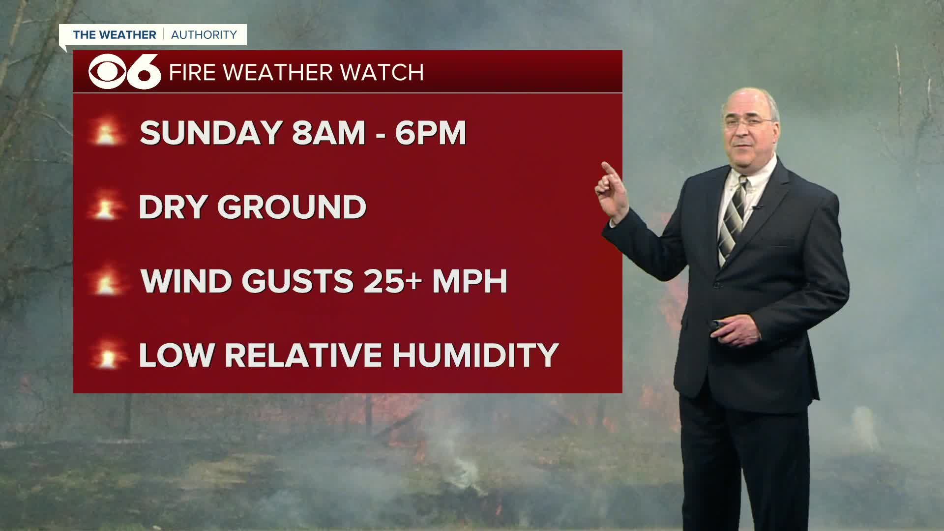
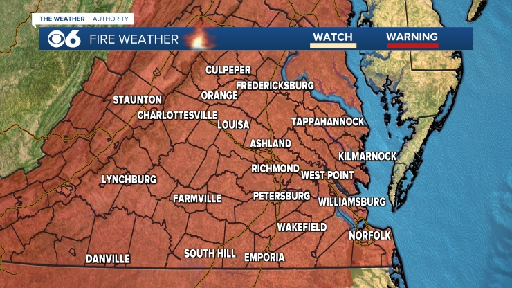
The cold front will move east of us during the morning. A shower or two could hang around through daybreak. Then the clouds will scatter, leading to a sunny day. Highs will be in the upper 60s to around 70. The wind will shift to the northwest, gusting over 25 mph at times. Due to the dry ground, low relative humidity, and gusty winds, a Fire Weather Watch is in effect for entire area. Any sparks or fires will spread rapidly.
Sunday night will be colder with lows in the low to mid 30s. Monday will then be sunny and cool, with highs in the mid to upper 50s. Lows Monday night will dip into the upper 20s to mid 30s.
Clouds will increase on Tuesday, and there may be a few showers later in the day. Highs will be in the mid 50s. Showers are likely Tuesday night into early Wednesday morning. Skies will remain mostly cloudy on Wednesday, with highs in the upper 50s.
Highs will get back into the low 60s on Thursday, with a few showers possible Thursday night. Friday should be the warmest day of the week, with afternoon highs around 70.
Stay With CBS 6, The Weather Authority.
STORM TRACKING LINKS:
Weather Alerts
Interactive Radar
Map Center
Hurricane Tracker
Closings & Delays
📱 Download the new and improved CBS 6 Weather App for iPhone and Android.


