

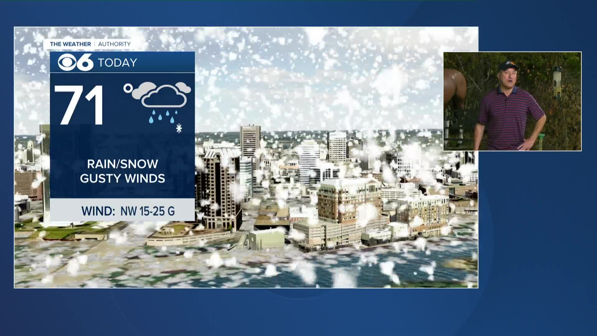

RICHMOND, Va. --A strong cold front will arrive this morning. Temperatures will be near 70° through 9am, but temperatures will fall quickly through late morning, ending up in the 35-40° range much of the afternoon.
There will be a batch of rain near and behind the front for the morning hours. Rain will mix with wet flakes around noon, with a few hours of snow showers in the afternoon. Surface temperatures will still be fairly warm, so the chance of accumulation is low. However, steadier snow showers may cool the ground enough to allow for a grassy coating.
Lows Thursday night will be in the upper 20s and lower 30s.
Friday will be mostly sunny with highs in the upper 50s to around 60.
Highs will get back into the 60s to around 70 this weekend. A few showers are possible Sunday.
It will be near 70 Monday, but another cold front will bring the chance of showers and storms. Lows Monday night will be in the upper 20s and lower 30s.
Highs Tuesday will be in the low to mid 40s. Lows Tuesday night will be in the 20s, with a hard freeze likely.
Highs will get back into the 60s later next week.
Stay With CBS 6, The Weather Authority.
STORM TRACKING LINKS:
Weather Alerts
Closings & Delays
Interactive Radar
Map Center
📱 Download the new and improved CBS 6 Weather App for iPhone and Android.


