

RICHMOND, Va. -- It will be a muggy and warm weekend. There will be more clouds around today, along with the chance of scattered showers and storms. Rain chances will be a little higher north of I-64 this morning, and south of I-64 this afternoon. Highs will be in the mid to upper 80s for most areas.
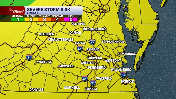
Not all areas will see storms today, but the storms that do develop will produce heavy rainfall, and could contain strong gusts. The entire region is under a marginal risk (level 1 out of 5) for severe storms due to the strong wind threat.
Tonight will be warm and muggy with lows in the upper 60s and lower 70s.
Sunday will have variable clouds with scattered showers and storms around. Rain chances will be a little higher during the afternoon. Strong gusts will be a threat again, with a marginal risk for central and southern Virginia.
Monday will be mostly dry, but an isolated storm or two will be possible. Highs will be in the mid to upper 80s.
Heat will intensify for the rest of the week. Highs will be in the lower 90s Tuesday, mid to upper 90s Wednesday, and near or a little above 100° Thursday and Friday.
The Richmond record high is 100° for both Thursday and Friday. It will be very humid, so the heat index will likely be over 105° both days, and could surpass 110° in spots.
Although an isolated storm or two cannot be ruled out towards the end of the week, the prospects for rain remain very low.
Stay With CBS 6, The Weather Authority.
STORM TRACKING LINKS:
Weather Alerts
Closings & Delays
Interactive Radar
Map Center
📱 Download the new and improved CBS 6 Weather App for iPhone and Android.


