


RICHMOND, Va. -- Monday will be hot and muggy, with afternoon highs in the low to mid 90s.
The heat index will be near 100°.
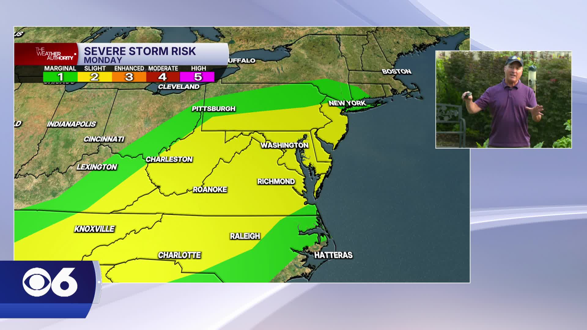
An approaching cold front will bring a few scattered storms later in the afternoon into the evening. A few storms could produce strong wind gusts and heavy rainfall.
Tuesday will then be a little cooler, with highs in the mid 80s.
A few isolated showers may pop up. Highs will then be in the mid to upper 80s with plenty of sunshine on Wednesday.
The next system will slowly approach from the west on Thursday. An isolated storm or two will be possible by evening. However, rain chances will be higher on Friday. Scattered storms may linger into the early part of next weekend.
All of Virginia continues to be in a drought. The area covered by extreme drought has decreased very slightly, but it still encompasses one-third of the state. The majority of the rest of the state is in a severe drought.
STORM TRACKING LINKS:
Weather Alerts
Closings & Delays
Interactive Radar
Map Center
📱 Download the new and improved CBS 6 Weather App for iPhone and Android.


