



RICHMOND, Va. -- Tonight skies will become partly cloudy with drier air. Temperatures will settle into the upper 60s to lower 70s overnight.
It will be cooler and less humid for Saturday. Highs will range from the mid to upper 80s near the coast to lower 90s inland, with dew points dropping into the 50s and 60s. Most areas will be dry with partly sunny skies.
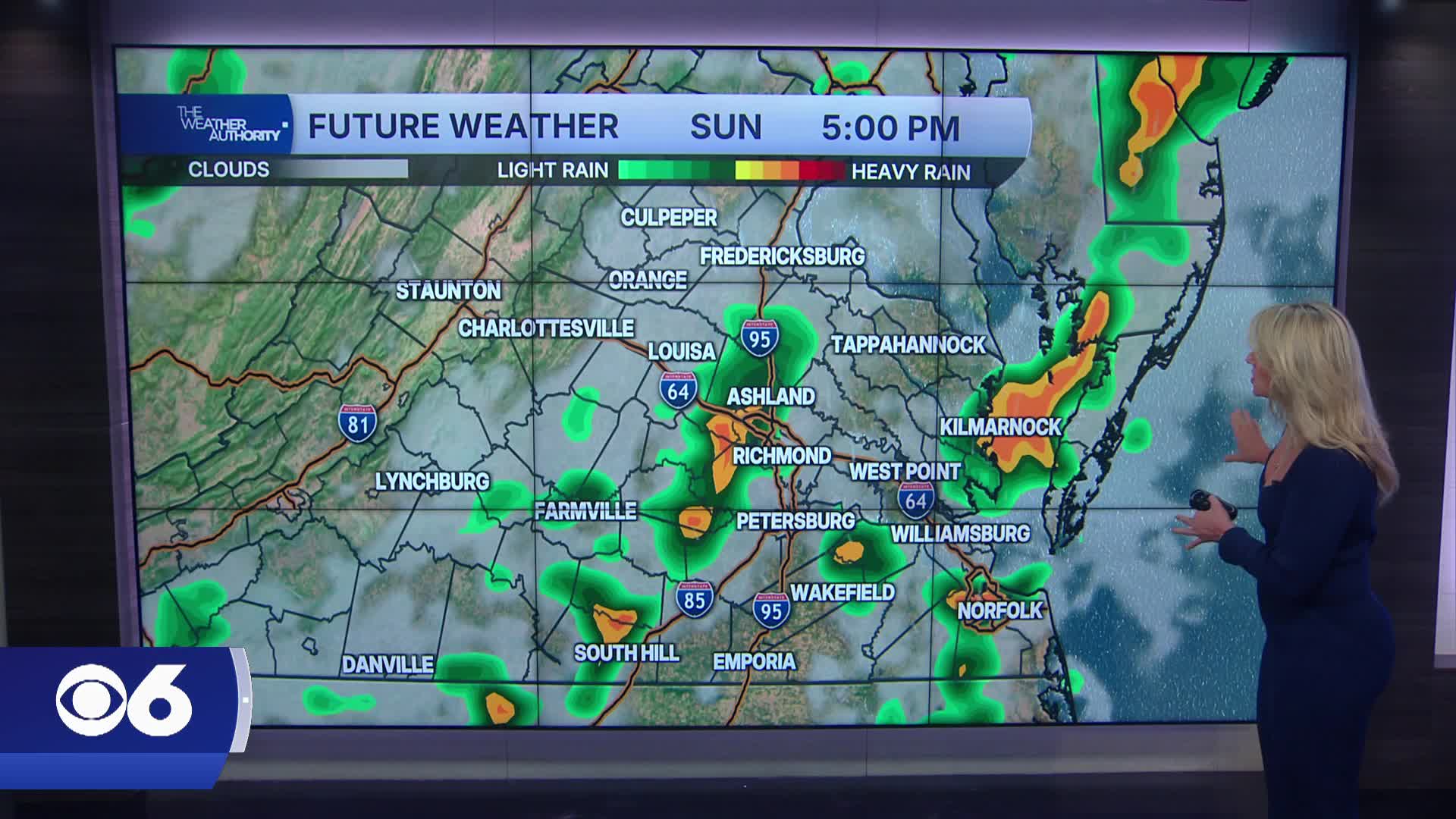
On Sunday the humidity surges again with highs in the low to mid 90s and heat indices climbing into the upper 90s to low 100s.
Another round of storms is possible late day with some storms becoming severe. The Storm Prediction Center has placed much of Virginia under a Slight Risk (2 out of 5) for severe thunderstorms, with damaging winds the main hazard.
Early next week a stronger front will stall nearby, keeping ample moisture and daily storm chances in play.
Highs will drop back into the 80s Monday through Wednesday, but conditions will stay somewhat unsettled with at least diurnal showers or storms.
Temperatures rebound into the 90s Thursday and Friday with humidity climbing again. Scattered showers and thunderstorms remain possible each day.
Stay With CBS 6, The Weather Authority.
STORM TRACKING LINKS:
Weather Alerts
Closings & Delays
Interactive Radar
Map Center
📱 Download the new and improved CBS 6 Weather App for iPhone and Android.


