


RICHMOND, Va. -- Friday will be a degree or two hotter, with highs in the upper 90s to 100°. The Richmond record high is 100° from 1914.
The heat index may break 105° in spots, and a heat advisory is in effect from 11 a.m. to 8 p.m. for parts of central and eastern Virginia.

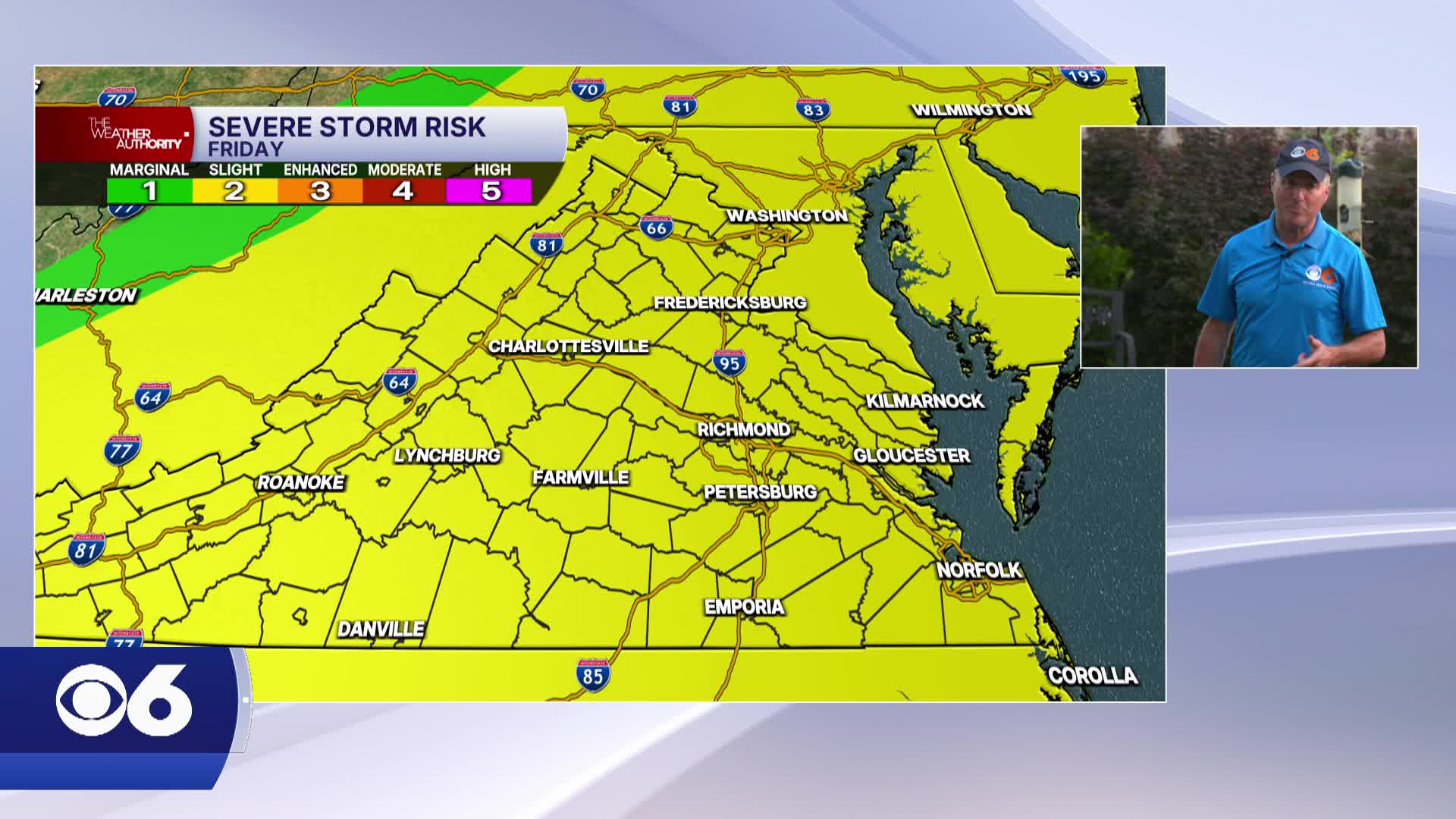
A few scattered storms will be possible by late Friday afternoon, with storms increasing during the evening. Heavy rainfall will occur with storms, and high gusts and some hail will also be possible. We have a slight risk (level 2 out of 5) for severe weather.
After a cold front passes, Saturday will be a lot less humid and not quite as hot. Highs will be in the upper 80s and lower 90s away from the coast.
Humidity surges again on Sunday with highs in the low to mid 90s. Scattered storms will be possible later in the day, and some of those storms could have strong gusts.
A stronger cold front will bring a bigger drop in heat and humidity for the first half of next week, but 90s will return Thursday into Friday.
A system to our south could provide a higher chance of rain for Tuesday.
Stay With CBS 6, The Weather Authority.
STORM TRACKING LINKS:
Weather Alerts
Closings & Delays
Interactive Radar
Map Center
📱 Download the new and improved CBS 6 Weather App for iPhone and Android.


