

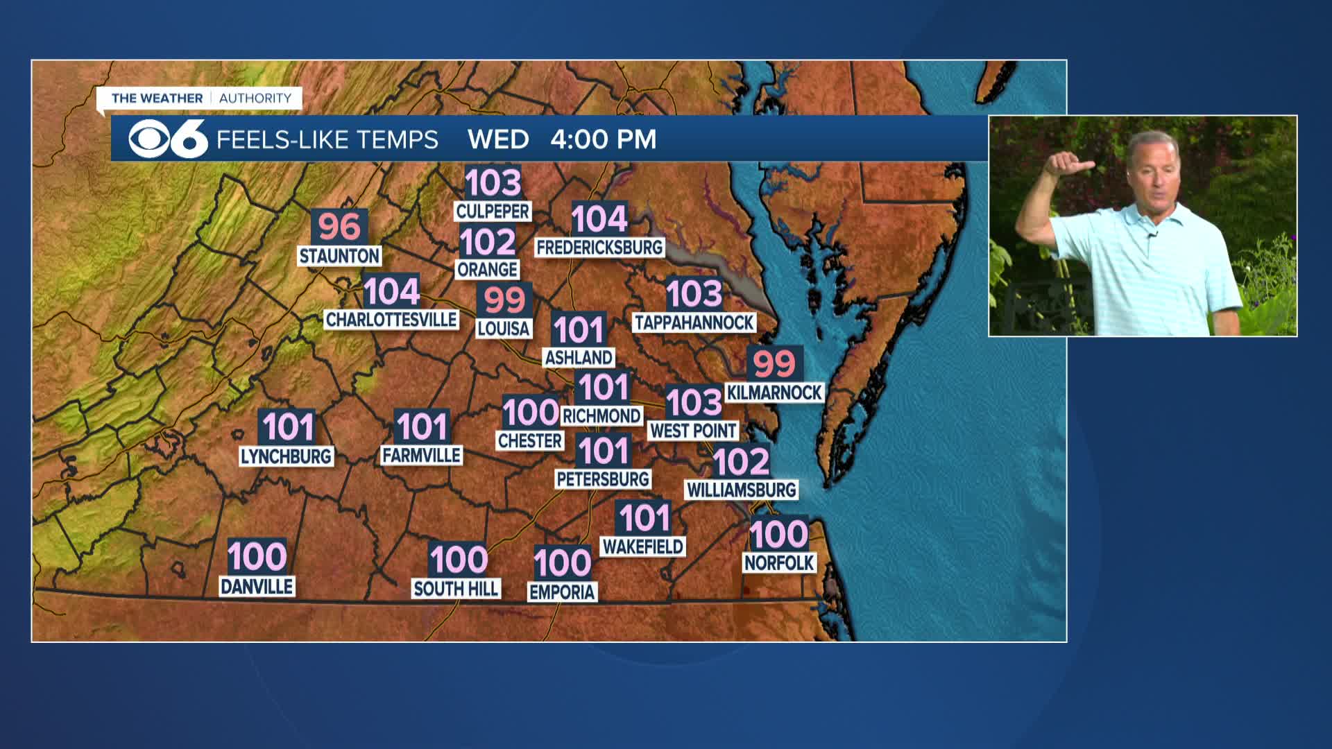

RICHMOND, Va. --It will be hot and more humid Wednesday with a high around 95 degrees feeling oppressive by mid afternoon. An isolated shower is possible by afternoon but the risk remains low. Otherwise expect mostly sunny skies with little to no wind.
A strong cold front will move through the region late Thursday into Friday with showers and thunderstorms Thursday evening and again on Friday. Heavy rain is likely with the potential for flash flooding.
Behind this front, it will be much a bit "cooler" and less humid over the weekend. Highs will be in the low 80s, and lows will mostly be in the low to mid 60s.
The first week of August will stay unseasonably mild and comfortable.
Stay With CBS 6, The Weather Authority.

STORM TRACKING LINKS:
Weather Alerts
Interactive Radar
Map Center
Hurricane Tracker
Closings & Delays
📱 Download the new and improved CBS 6 Weather App for iPhone and Android.


