


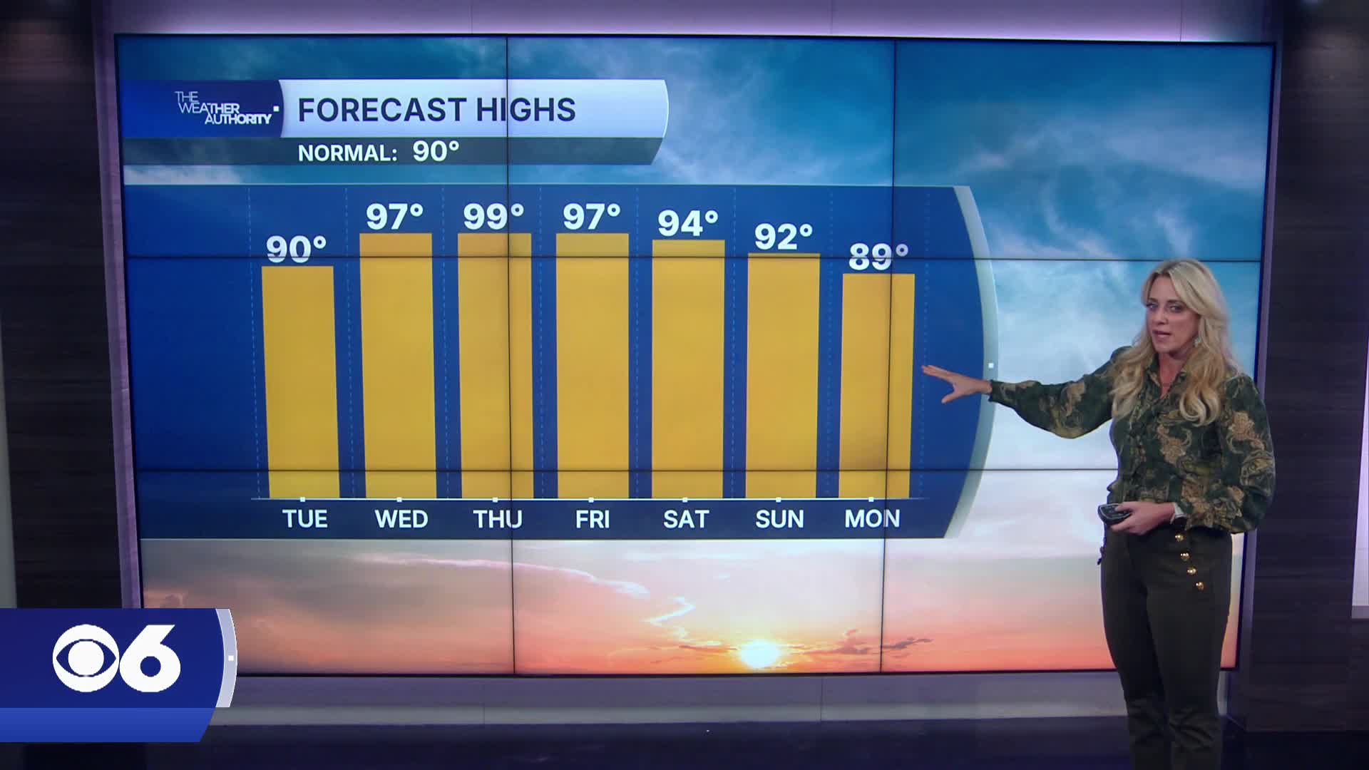

RICHMOND, Va. -- Tuesday brings another quiet and pleasant summer day with mostly sunny skies across Virginia. Highs will warm back into the mid and upper 80s, but humidity levels stay relatively comfortable for July standards.
The big weather story this week is the return of dangerous heat.
Temperatures climb into the low and mid 90s Wednesday before soaring into the mid 90s to near 100 degrees Thursday and Friday.
Even though humidity won’t be extreme, heat index values will still push into the upper 90s and low 100s with Heat Advisories becoming increasingly likely late week.
The heat sticks around into the weekend, but storm chances will also begin to increase.
Most of Friday still looks dry, but scattered thunderstorms become more likely Saturday and Sunday as a weakening front approaches the region.
Some of those weekend storms could produce heavy downpours and damaging wind gusts especially during the afternoon and evening hours.
Stay With CBS 6, The Weather Authority.
STORM TRACKING LINKS:
Weather Alerts
Closings & Delays
Interactive Radar
Map Center
📱 Download the new and improved CBS 6 Weather App for iPhone and Android.


