


RICHMOND, Va. -- A large ridge of high pressure over the Tennessee Valley will strengthen and expand eastward over the next several days. A dangerous combination of heat and humidity is expected in Virginia as the high impacts the Commonwealth Wednesday through the holiday weekend.
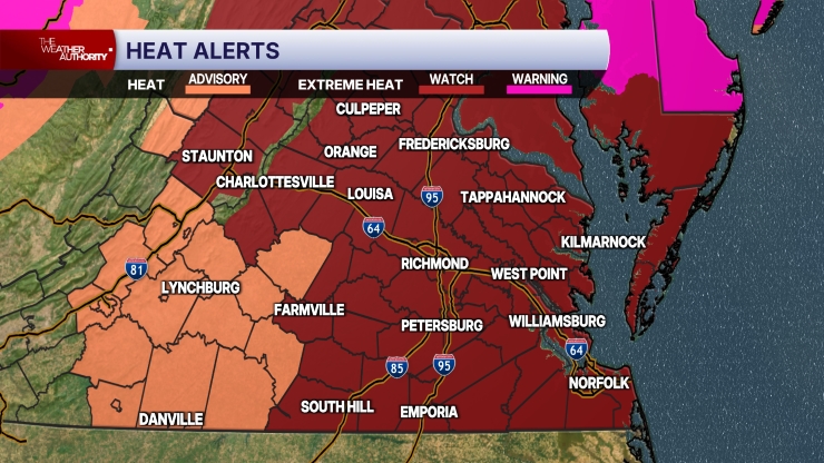
Wednesday will be very hot and humid, with mid to upper 90s and heat index values up to 106. A Heat Advisory is in effect for roughly the northwest half of Virginia.
The hottest weather will occur Thursday through Saturday, but dangerous heat will continue Sunday.
Friday and Saturday have a good chance to go into the record books, with highs of 102 and 100 respectively.
The heat index will likely fall into the range of 106 to 110 both days.
An isolated afternoon shower or storm will be possible Saturday and Sunday.
More widespread showers and storms will be possible early next week.
A weak disturbance off the Mid-Atlantic coast has a very low chance of tropical storm development over the next few days.
Stay With CBS 6, The Weather Authority.
STORM TRACKING LINKS:
Weather Alerts
Closings & Delays
Interactive Radar
Map Center
📱 Download the new and improved CBS 6 Weather App for iPhone and Android.


