

RICHMOND, Va. -- A strong cold front has passed, and it will be very cold and breezy this morning. Temperatures will be in the single digits and teens early this morning, with wind chills near or below zero.
A cold weather advisory is in effect until 10 a.m. Saturday.

A winter storm will impact the region from late today into Monday. Winter Storm Warnings are in effect for the entire state.

TODAY: Increasing clouds and cold. Highs in the 20s. Snow moves in from the west, reaching western Virginia late this afternoon, and central Virginia this evening.
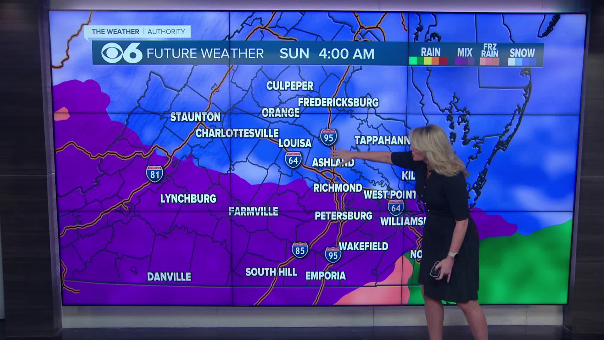
TONIGHT: Accumulating snow. Snow will turn to sleet (ice pellets) across southern Virginia around or after midnight. This will track northward and reach the metro by daybreak Sunday. Lows in the teens.

SUNDAY: Sleet pushes farther north and northwest in the morning. Sleet changes to freezing rain from southeast to northwest during the day, with periods of heavy freezing rain in the afternoon and evening. Significant ice accumulation with widespread power outages likely. Highs in the 20s to around 30. Coastal areas may reach the mid 30s and switch over to plain rain.
Weather Alerts — Closings & Delays — Download the CBS 6 Weather App for iPhone and Android.
SUNDAY NIGHT: Precipitation will end from west to east before daybreak Monday. Lows in the upper teens to mid 20s.
Snow accumulation forecast: for the metro and points south, most of this accumulation will occur before noon Sunday.

Ice accumulation forecast from freezing rain:
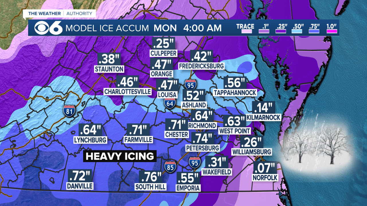
Power outage potential: The ice storm portion of this weekend's system could provide historic ice accumulations. This may result in significant and widespread power outages, potentially for multiple days in some locations. The week ahead will be very cold with highs in the 20s to around 30, and lows ranging from zero to the mid-teens.

MONDAY: Partly cloudy and cold. Highs 25-30°.
MONDAY NIGHT: Lows 0° to 10°.
Highs will reach the low to mid 30s on Wednesday. A cold front will pass Wednesday evening into early Thursday with some flurries or snow showers possible. Behind the front, colder air will be reinforced for the end of the week.
Stay With CBS 6, The Weather Authority.
STORM TRACKING LINKS:
Weather Alerts
Closings & Delays
Interactive Radar
Map Center
📱 Download the new and improved CBS 6 Weather App for iPhone and Android.


