

RICHMOND, Va. -- Today will be partly cloudy with highs near 50°. Lows will drop to 10-18° tonight.
A cold weather advisory is in effect from 8 p.m. this evening until 10 a.m. Saturday for the region. In addition to cold temperatures, wind chills will range from -5° to 5°.
A winter storm watch is in effect for the entire state from Saturday afternoon through Monday morning. This will be upgraded to a warning.

SATURDAY: Dry much of the day with increasing clouds. Cold with highs in the low to mid 20s. Snow moves into western Virginia by late afternoon, and the metro towards evening.

SATURDAY NIGHT: Periods of snow for many areas. Snow will transition to sleet (ice pellets) across southern Virginia, with the sleet moving northward into Richmond in the morning. Lows in the teens.
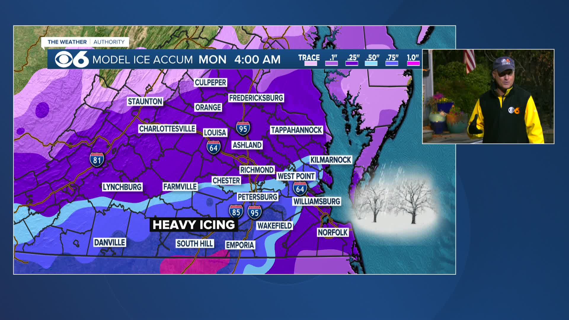
SUNDAY: Sleet will continue tracking into northern Virginia. Sleet will change to freezing rain (liquid rain falling and freezing on impact, creating ice) from south to north. A major ice event is expected, and widespread power outages may occur. Highs in the 20s.
SUNDAY NIGHT: Precipitation tapers off from west to east before daybreak Monday. Lows in the teens.

Accumulation Forecast:

Ice accumulations:

MONDAY: Partly cloudy and cold. Highs 25-30°.
MONDAY NIGHT: Lows 0° to 10°.
Highs will be in the 20s Tuesday and the 30s Wednesday. Overnight lows will be in the teens and 20s.
Another shot of colder air will arrive by next weekend.
Stay With CBS 6, The Weather Authority.
STORM TRACKING LINKS:
Weather Alerts
Closings & Delays
Interactive Radar
Map Center
📱 Download the new and improved CBS 6 Weather App for iPhone and Android.


