

RICHMOND, Va. -- Thursday will be the mildest day for quite a while with highs in the mid to upper 50s.
A very strong cold front will arrive Friday night bringing the coldest air of the season to the Commonwealth.
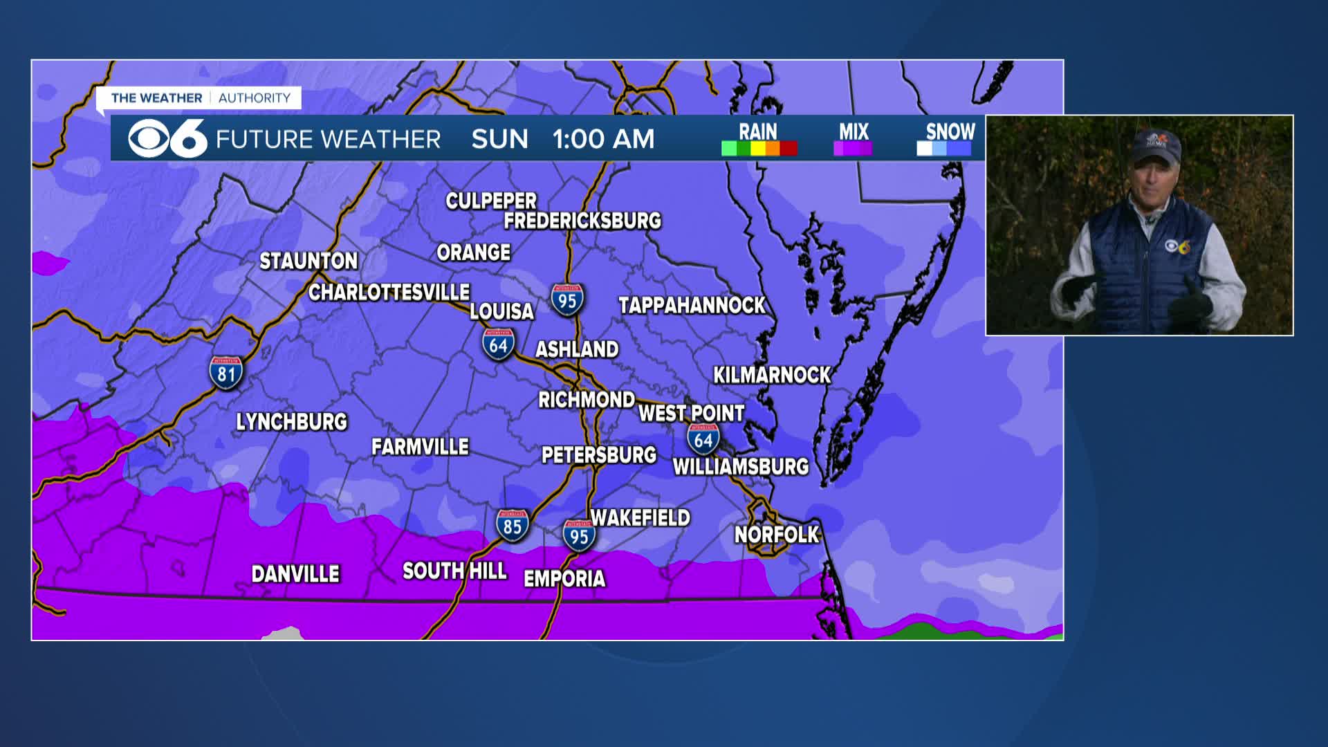
Snow will develop by Saturday evening. Snow will continue overnight but will transition to sleet from south to north Sunday morning.
The storm will gradually move east of the area early Monday morning, but not before significant amounts of snow and ice occur.
The air mass in the wake of this storm will be very cold, with single-digit lows and highs that remain below freezing through mid week.
Stay With CBS 6, The Weather Authority.
STORM TRACKING LINKS:
Weather Alerts
Closings & Delays
Interactive Radar
Map Center
📱 Download the new and improved CBS 6 Weather App for iPhone and Android.


