


RICHMOND, Va. -- Tonight will cold with lows in the teens and 20s. Winds will increase by morning. Some flurries will be possible until around daybreak Saturday.
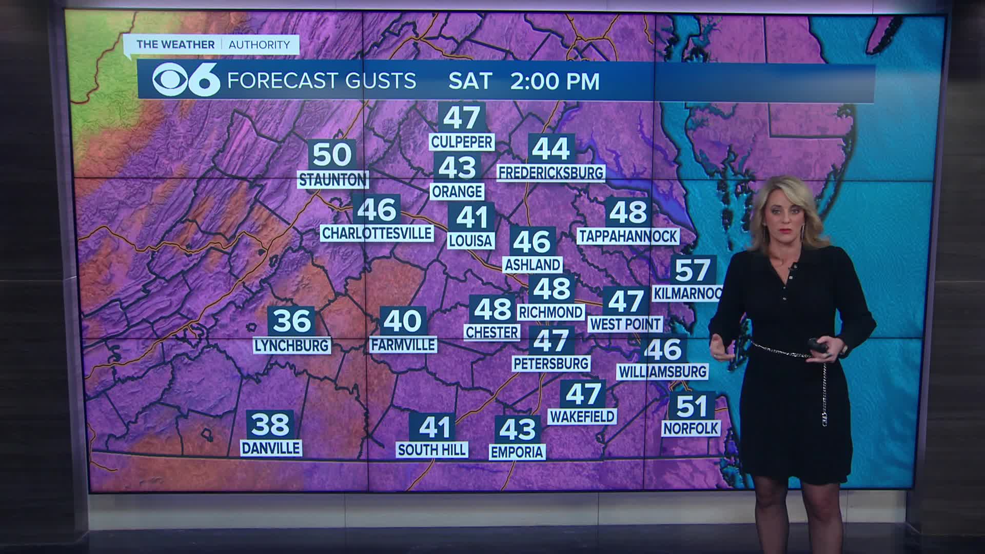
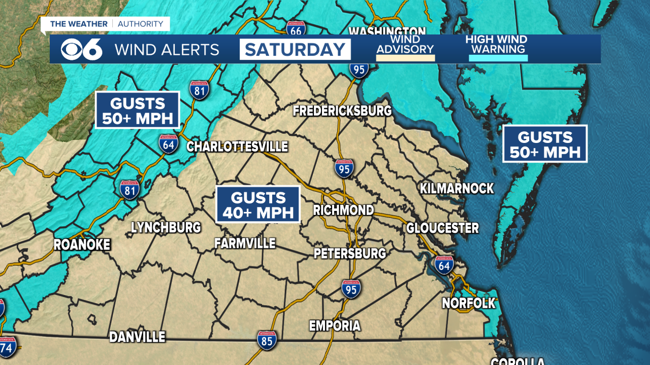
Saturday will be sunny, windy and very cold.
Winds will gust over 40 mph across much of Virginia, with some gusts over 50 mph at the coast and in the mountains.
Wind advisories and high wind warnings are in effect for Saturday. Highs will be in the upper 20s and lower 30s.
Wind chills will be near or below zero at times Saturday through Saturday night into Sunday morning. Cold weather alerts have been issued for that period.
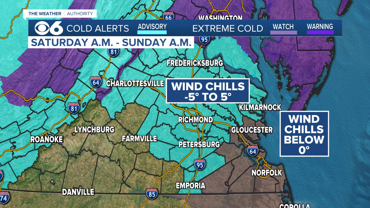
Lows Sunday morning will be in the single digits and teens.
Sunday afternoon will be sunny and less windy. Highs will be in the upper 20s and lower 30s.
A warmer pattern will develop next week, with highs in the 50s Tuesday and Wednesday.
A few showers will be possible Wednesday and Thursday.
WATCH NOW: Live look at radar, current conditions across Virginia
Stay With CBS 6, The Weather Authority.
STORM TRACKING LINKS:
Weather Alerts
Closings & Delays
Interactive Radar
Map Center
📱 Download the new and improved CBS 6 Weather App for iPhone and Android.
Closings | Interactive Radar | Weather Alerts
iPhone News App | Android News App
iPhone Weather App | Android Weather App
Depend on the CBS 6 Weather Authority to keep you ahead of the storm. Watch CBS 6 News and stay with WTVR.com for complete coverage of this winter blast.


