


RICHMOND, Va. -- Another round of snow is headed to Virginia Monday with a similar setup to what we experienced on Friday.
This event, however, will have colder temps to work with, and a prolonged period of light snow should result in higher snowfall totals in some parts of Virginia.
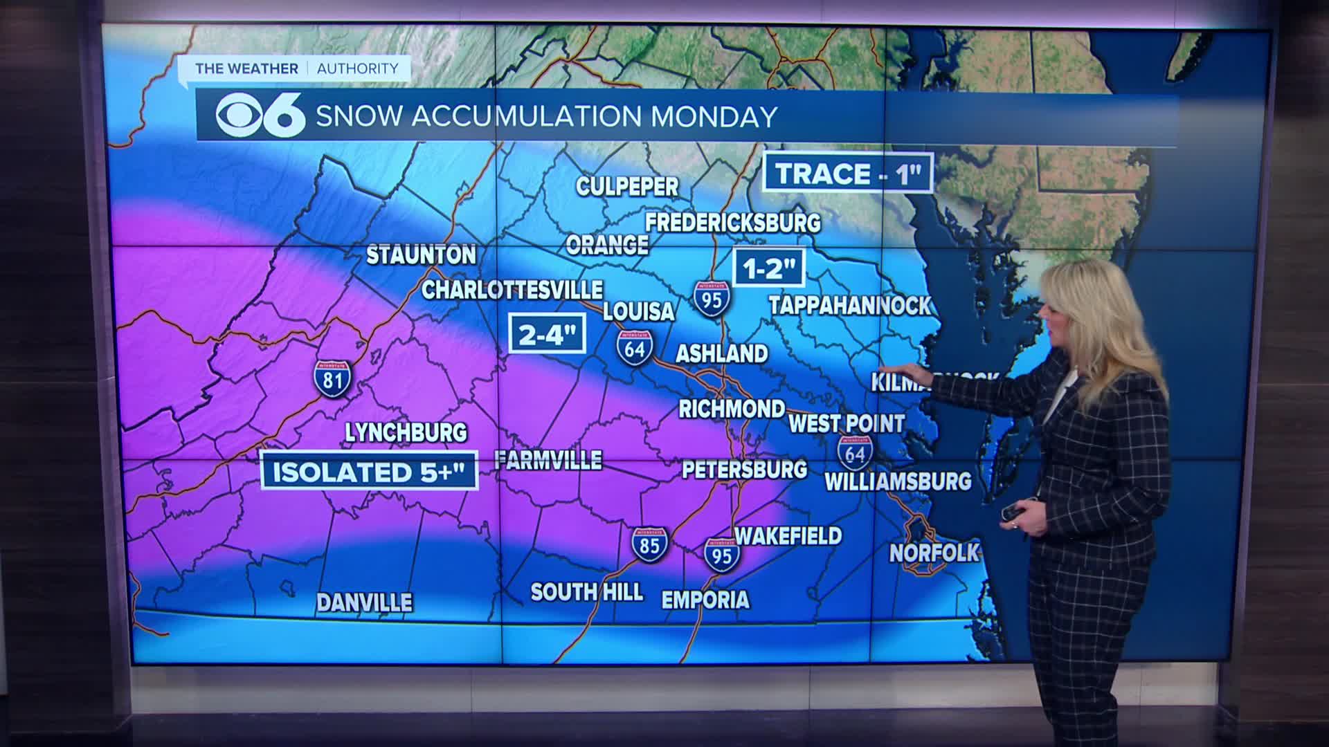
Snow will be most impactful during the late morning and afternoon with the greatest accumulations during that time. It will become more scattered as it winds down between 6PM-9PM.
Much of central and southern Virginia will experience snowfall totals between 3-5 inches. Lesser amounts north of Hanover County.
Temperatures will slowly fall throughout the day, reaching the upper teens and low 20s Tuesday morning. Untreated surfaces will be icy.

Temperatures will warm back to around 50 mid-week.
We are watching another system for late Thursday into Friday. Much of that looks to be rain, but some mixed precipitation is possible Friday morning. Recent computer models have weakened this system, and a few models have no precipitation at all.
Stay With CBS 6, The Weather Authority.
STORM TRACKING LINKS:
Weather Alerts
Interactive Radar
Map Center
Hurricane Tracker
Closings & Delays
📱 Download the new and improved CBS 6 Weather App for iPhone and Android.


