


RICHMOND, Va. — Here is the latest on Hurricane Erin:
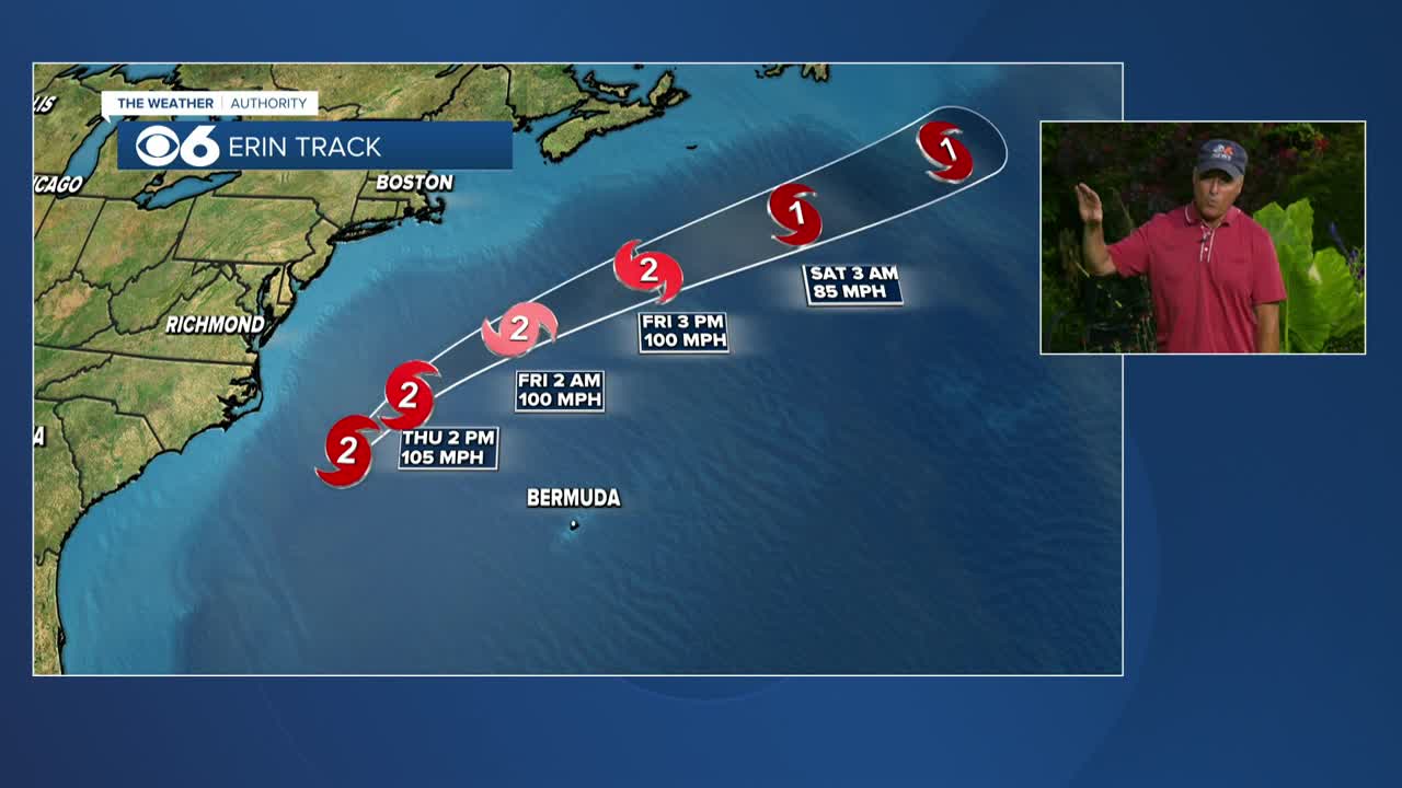
- Category 2 hurricane moving between the East Coast and Bermuda
- Center of the storm is around 330 miles southeast of Cape Hatteras, and will remain well offshore
- possible strengthening and fluctuations in wind speeds will occur
Impacts to the Mid-Atlantic coast.
- Waves over 12 feet will be possible along the Atlantic coast. Dangerous rip currents will continue, and high surf advisories are in effect.
- Tropical Storm Warnings are in effect for the waters off the Atlantic coast, as well as for the Chesapeake Bay. Wind gusts in excess of 39 mph are possible.
- Coastal Flood Alerts are in effect Thursday into Friday for all of eastern Virginia. Water levels will be 1 to 3 feet above normal during high tide cycles.
More information can be found in the CBS 6 Hurricane Tracker.
Local forecast:
Thursday will be mostly cloudy and breezy with a few showers possible. It will remain muggy with highs in the upper 70s and lower 80s. Clouds will break for more sun later in the day. Winds will gust over 25 mph across central Virginia, and over 35 mph at the coast.
Friday and Saturday will be mostly sunny and less humid with highs in the lower 80s.
A cold front may bring a few scattered storms Sunday afternoon. It will be more humid with highs in the mid to upper 80s.
It will turn a lot less humid next Monday into Tuesday.
Stay With CBS 6, The Weather Authority.
STORM TRACKING LINKS:
Weather Alerts
Interactive Radar
Map Center
Hurricane Tracker
Closings & Delays
📱 Download the new and improved CBS 6 Weather App for iPhone and Android.


