


RICHMOND, Va. -- Tonight will be warm and humid, with mostly clear skies and lows in the mid to upper 60s.
Sunday will be mostly sunny, hot and humid. Most locations away from the coast will be in the low to mid 90s, with a heat index up to near 100°. An isolated shower or storm is possible, mainly later in the day. A few showers and storms are a possibility Sunday night.
Monday will bring a mix of sun and clouds, along with a few scattered showers and thunderstorms. Highs will be in the upper 80s to around 90.
The rest of the week will not be as hot, although still a bit humid. A few showers or storms may pop up each day, particularly Thursday and then again on Saturday. Highs will be in the mid to upper 80s Tuesday and Wednesday, and then the low to mid 80s Thursday into the weekend.
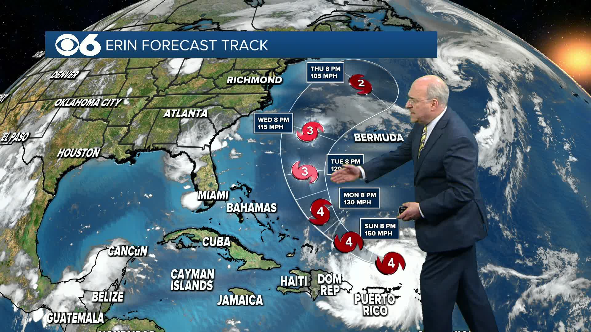
Hurricane Erin peaked in strength as a Category 5 hurricane earlier Saturday, and is now a Category 4 storm. It's now located north of Puerto Rico. The storm will track west-northwest and then northwest, staying east of the Bahamas. It will then curve to the north and northeast, passing between the East Coast and Bermuda. The main impacts for the Mid Atlantic will be high waves, strong rip currents, tidal flooding and beach erosion.
More information can be found in the CBS 6 Hurricane Tracker.

Stay With CBS 6, The Weather Authority.
STORM TRACKING LINKS:
Weather Alerts
Interactive Radar
Map Center
Hurricane Tracker
Closings & Delays
📱 Download the new and improved CBS 6 Weather App for iPhone and Android.


