


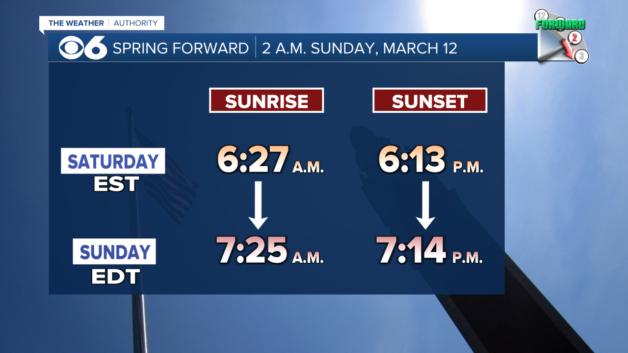
RICHMOND, Va. -- AN IMPORTANT REMINDER — clocks "spring forward" one hour at 2 a.m. Sunday to Daylight Saving Time.
Clouds will increase across the area overnight. Temperatures will dip into the upper 20s and low 30s. Rain will then spread into the metro by around midday or early afternoon. This could begin as a mix, mostly well west of I-95. Highs will be in the chilly 40s.
Showers will continue through Monday morning. Skies may brighten later in the afternoon, with highs in the low to mid 50s.
Tuesday will be partly to mostly sunny, breezy and cool with highs in the upper 40s to around 50. Lows Tuesday night will range from the mid 20s to low 30s. Wednesday will bring plenty of sun, but temperatures will remain a bit below normal in the low and mid 50s.
Thursday will turn warmer, with readings reaching the low 60s and we'll likely reach the low 70s on Friday. Both days are expected to be dry.
As of now, it looks like our next threat of rain will come at the start of next weekend.
STORM TRACKING LINKS:
Weather Alerts
Closings & Delays
Interactive Radar
Map Center
📱 Download the new and improved CBS 6 Weather App for iPhone and Android.


