


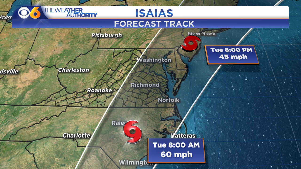
RICHMOND, Va. -- Tropical Storm Isaias will track to the northeast, over the Atlantic Ocean off the coast of Georgia on Monday. It will make a landfall along the South Carolina coast, closer to the North Carolina/South Carolina border, Monday night.

The storm will then track through eastern North Carolina and eastern Virginia.
A tropical storm warning has been issued for central and eastern Virginia, including the Richmond metro and the Interstate 95 corridor and points east. This means tropical storm conditions are expected within the warning area within 36 hours.
Locally, rain shower activity will increase late Monday into Monday night. Rain will turn steady and heavy Tuesday morning, and last through at least early Tuesday afternoon.
A flash flood watch is in effect for the entire CBS 6 viewing area.
Rainfall amounts of 2 inches or more will affect most locations. There will also be the potential for some spots receiving over 4 inches.
Here is just one computer model showing the possible rainfall amounts.
Wind gusts will increase Tuesday morning into Tuesday afternoon. Gusts over 30 mph are expected across much of central Virginia. Gusts will exceed 45 mph near the coast, and a few locations could get gusts over 55 mph.
Due to the rainfall, wind direction and full moon, coastal water levels could be 1 to 3 feet above normal during high tide cycles.
As the storm center moves through, isolated tornadoes will be possible. If tornadoes do develop, the chance is higher east of I-95.
Conditions will improve late Tuesday as the storm exits to the northeast.
Stay With CBS 6, The Weather Authority for additional updates.
STORM TRACKING LINKS:
National Hurricane Center
Weather Alerts
Interactive Radar
Map Center


