

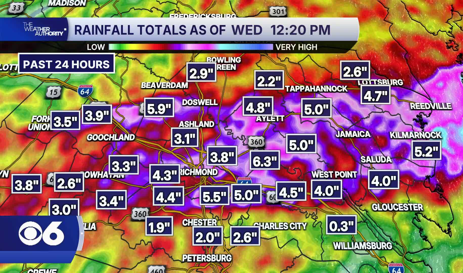


HENRICO COUNTY, Va. — Storms that rolled through Metro Richmond from Tuesday afternoon through Wednesday morning dropped up to six inches of rain in isolated spots, with numerous damage reports across the region.
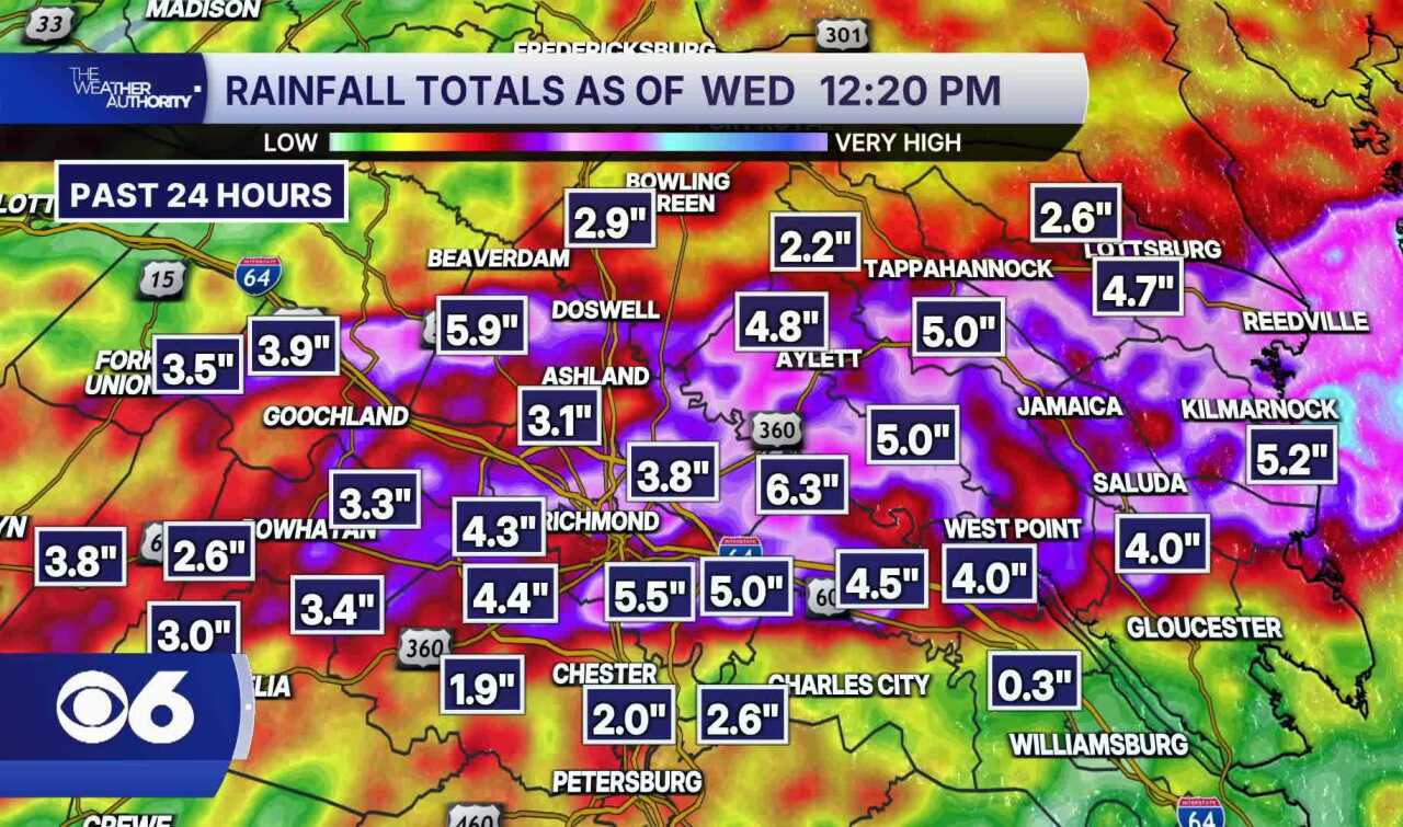
Storms that moved through Metro Richmond from Tuesday, July 21 through 12:20 p.m. Wednesday, July 22 produced significant rainfall totals across the region, with some areas hit far harder than others.
These are doppler radar estimates of rainfall. The radar tends to over-estimate rainfall when the storms contain hail.
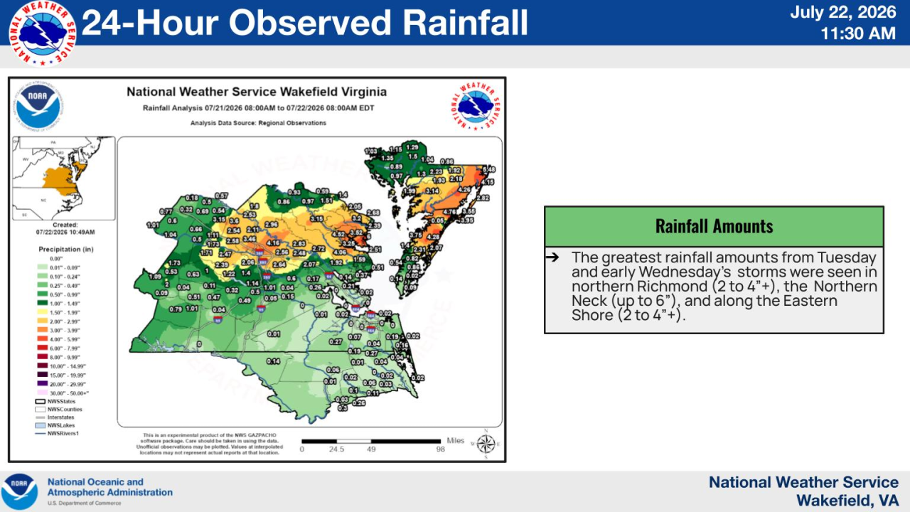
This is a plot of recorded rainfall from the National Weather Service in Wakefield.
CBS 6 Meteorologist Mike Stone said most of the heaviest rain fell in isolated pockets, with some sections recording more than three inches.
Far southern areas of Metro Richmond saw comparatively little rainfall during the same period.
The storms produced numerous damage reports across the region. Standing water was reported at several flood-prone intersections across Richmond, including at the corner of 36th Street and Midlothian Turnpike Wednesday morning.
The recurring flooding in Richmond's most vulnerable neighborhoods is the focus of an ongoing University of Richmond research study. The Go With the Flow study, led by non-profit Southside ReLeaf and UR Professor Todd Lookingbill, recently received a $150,000 grant to continue tracking flood hot spots across the city for the next three years.
-
-
Eat It, Virginia! with Scott and RobeyUntold with Catie Beck
-
-
-
This story was initially reported by a journalist and has been converted to this platform with the assistance of AI. Our editorial team verifies all reporting on all platforms for fairness and accuracy. To learn more about how we use AI in our newsroom, click here.
 Facebook
  TikTok
  YouTube
 Blue Sky
 Instagram
 Threads
 X
X


