

RICHMOND, Va. -- It is a cold morning with scattered clouds. A light breeze is producing wind chills in the 20s.
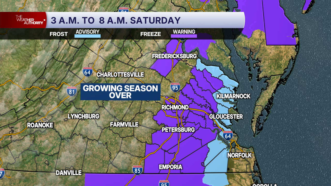
A freeze warning is in effect until 8 a.m. well away from the coast for areas that have not had a freeze this season. A frost advisory is in effect for eastern Virginia.
Similar to Friday, today will feature sunshine with increasing cloudiness. Highs will be in the low to mid 50s.
Tonight will be mainly clear and cold. Lows will be in the upper 20s and lower 30s away from the coast.
Sunday will have sun with variable cloudiness during the day. Highs will be in the low to mid 50s.
Morning lows will stay in the upper 20s and lower 30s each morning for most of the week ahead. This will produce frost/freeze conditions, with the potential for a hard freeze in our coldest outlying areas, where lows may dip into the mid 20s.
Afternoon highs will be in the low to mid 50s Monday, 55-60° Tuesday, the lower 60s Wednesday, and 65-70° Thursday and Friday.
Dry weather will last into next weekend.
Stay With CBS 6, The Weather Authority.
STORM TRACKING LINKS:
Weather Alerts
Closings & Delays
Interactive Radar
Map Center
CBS 6 Hurricane Tracker
📱 Download the new and improved CBS 6 Weather App for iPhone and Android.