

RICHMOND, Va. -- Thursday will continue to be hot and muggy. Highs will be in the low to mid 90s, and the heat index will break 100°.
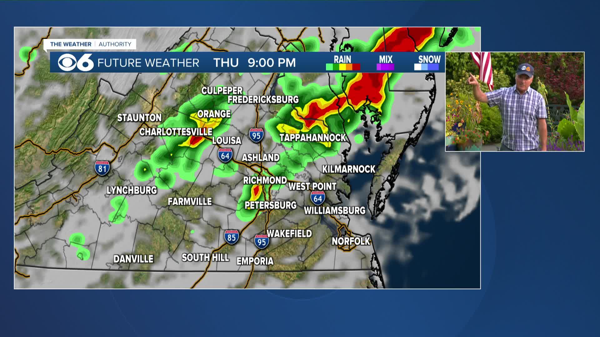
A few scattered storms will be possible in the afternoon, with storms increasing in the evening as a cold front approaches. Storms could be strong, and there is a marginal risk (level 1 out of 5) for severe storms with high wind gusts.
Due to the muggy air, storms will produce very heavy rainfall, and localized poor-drainage flooding is possible. A flood watch is in effect for northern Virginia.

The cold front will be to our southeast on Friday, keeping the chance for a few showers or storms in the area. The best chance for rain will be in southeastern Virginia. It will be cooler and not quite as muggy with highs in the low to mid 80s.
This weekend will be more comfortable with less humid air and highs in the upper 70s and lower 80s. Overnight lows will be in the upper 50s and lower 60s away from the coast.
It will turn gradually more humid next week. A system could provide some showers late Tuesday into Wednesday. Highs will be in the low to mid 80s.
Stay With CBS 6, The Weather Authority.
STORM TRACKING LINKS:
Weather Alerts
Interactive Radar
Map Center
Hurricane Tracker
Closings & Delays
📱 Download the new and improved CBS 6 Weather App for iPhone and Android.


