


A fast-moving upper-level storm system will bring a round of snow to North Carolina and Virginia on Friday. The storm is currently (as of 6:30 p.m.) located over southwestern Iowa, and will move southeast through North Carolina Friday.

The greatest lift and moisture will be across eastern North Carolina, where 2-4" of snow is very likely, and a winter storm warning (pink areas) is in effect.

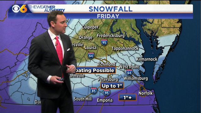
A lesser amount of snow is expected farther north and east, where a winter weather advisory is in effect for 1-2" of snow.

A very minor amount of snow (a dusting) is possible as far north and west as Richmond, but the greater chance of a ground covering snow will be across southern Virginia and Hampton Roads.

Another upper-level disturbance will increase snow chances across the Virginia Blue Ridge into West Virginia, with north central and northeast Virginia seeing the lowest chances of snow.

The timing of this system for the Richmond metro area will be afternoon and early evening, with the peak probability around 3 p.m.

Stay with CBS 6, The Weather Authority. -Zach

