


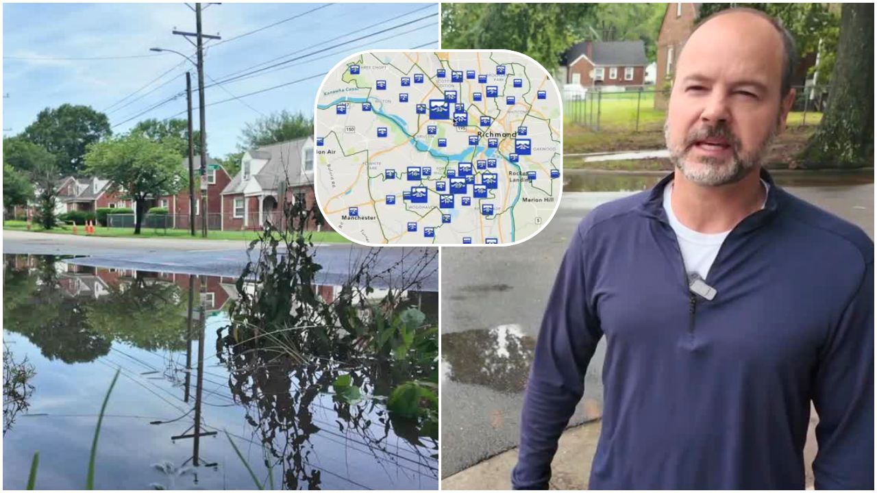


RICHMOND, Va. — Heavy storms rolled through the Richmond metro area Tuesday and overnight into Wednesday morning, leaving standing water at flood-prone intersections across the city. At the corner of 36th Street and Midlothian Turnpike, city crews arrived by 2 p.m. Wednesday and cleared the standing water within minutes.
The apparent cause was a hubcap blocking the drain — a small but telling example of the kind of infrastructure issues that University of Richmond Professor Todd Lookingbill and the non-profit Southside ReLeaf have spent the past year working to document.
CBS 6 Meteorologist Mike Stone said rainfall totals from the past 24 hours showed significant variation across the region. Some areas recorded more than three inches of rain, with isolated spots in Virginia receiving more than six inches. Far southern areas saw comparatively little rainfall.
Lookingbill is part of the Go With the Flow study, led by Southside ReLeaf — a Richmond-based non-profit focused on urban forestry, increasing the city's tree canopy cover, and ensuring every resident lives within a 10-minute walk or 2-mile radius of a park or green space. The organization has expanded its community focus to include flooding through the Go With the Flow partnership.
In the spring and summer of 2025, the study asked Richmond residents to submit reports of flooded areas in their neighborhoods. Hundreds of submissions poured in, and researchers used that data to build an interactive map showing the location, details, and photos of flood hot spots across Richmond and beyond.
Lookingbill said the data revealed clear patterns in where flooding tends to occur.
"Areas that tend to be prevalent, storm after storm, we see flooding occur on the ground," Lookingbill said.
He said the submissions pointed to specific types of locations that flood repeatedly.
"They are oftentimes at intersections. They are sometimes on people's walks to bus stops in areas I mentioned previously, that's an area of concern that we're seeing that tend to be reported more often than others," Lookingbill said.

The survey is back up and running for 2026 and will now operate year-round to give researchers a fuller picture of flooding patterns across seasons. The ultimate goal is to bring the data directly to the city's attention so infrastructure improvements can be prioritized.
"If there's drain pipes that are clogged, kind of identify those so those can be unclogged. If there's just depressions in the ground that fill up time after time, kind of identify those. If there's areas that are next to bus stops that are particularly troublesome, kind of make those priority areas for the city to kind of take a look at," Lookingbill said.
The study recently received a $150,000 grant to continue the work for the next three years. Along with the year-round survey, researchers plan to place electronic sensors in known flood hot spots for constant monitoring and will hold community conversations with frequently flooded neighborhoods to better understand how the flooding is affecting residents' daily lives.
Lookingbill said the human impact of flooding goes beyond inconvenience.
"They could be late for work because of inconveniences because of the flooding, either walking or driving, but they also could be just inconvenienced in a way that kind of makes them wear wet clothing all day, or they have increased exposure to environmental contaminants, kind of sitting and standing water," Lookingbill said.
Looking ahead, Lookingbill said the team hopes to develop the program into a model that can be replicated by other cities facing similar challenges.
-
Giving You A Voice
-
Your Voice, Your Story
🎙️ WTVR Podcasts
-
Eat It, Virginia! with Scott and Robey
Untold with Catie Beck
This story was initially reported by a journalist and has been converted to this platform with the assistance of AI. Our editorial team verifies all reporting on all platforms for fairness and accuracy. To learn more about how we use AI in our newsroom, click here.
-
 Facebook
  TikTok
  YouTube
 Blue Sky
 Instagram
 Threads
 X
X

