

We’re busy tracking an Arctic cold front that should arrive in central Virginia on Tuesday. This will produce gusty breezes, plenty of clouds and a few scattered rain showers that could turn to a few snowflakes behind the front during the late afternoon and early evening. Either way, a taste of “winter” will be in the air.
Obviously Arctic air this time of the year isn’t as cold as it would be in January/February, but our forecast high temperature for Wednesday is in the mid 40s. That is well below “normal” for this time of year, and the first time we would have a high of 45° or lower since March 25th.
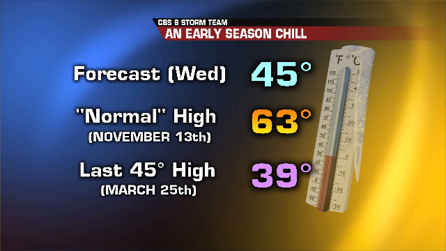
By the way, the first time we had a high temperature of 45° or lower last year (2012) was December 24th! So get ready for a real chill in the air midweek, with overnight lows below the freezing mark for several days. Afternoon highs will moderate Thursday through Saturday.
Stay warm!
Mike Goldberg

